Sunken Barge In Georgian Bay

McCrae Lake lies right next to Georgian Bay, but with just enough of a rock ledge that there are (usually) no motor boats. Situated in a conservation reserve it’s devoid of cottages, and yet surrounded by a variety of the unique terrain that makes Georgian Bay such a lovely place to visit.

Picture
Parking

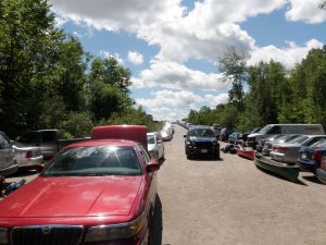
The downside are the crowds. Located just over an hour from the GTA it attracts huge numbers of weekenders. The access road is often so packed that it’s hard to find a parking spot. Finding a campsite can be almost impossible, and when you do there’s a good chance that it’s been trashed. Still, it’s such a beautiful spot that I’ve returned several times for day trips.

This was my first visit to McCrae, and the lake wasn’t even my goal. I wanted to find the “Sunken Barge” geocache on Georgian Bay.  The description didn’t mention where we should put in, so I checked my copy of Kevin Callan’s “A Paddler’s Guide To Cottage Country” and he had a route from McCrae lake up to the cache.

McDonald Lake

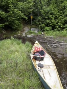
After a short portage down from the parking area we put in on McDonald Lake. McDonald is really a small beaver pond. Even though it has a view of cars whizzing by on the highway it’s a beautiful spot in its own right. The pond weaves back and forth, to the portage. Apparently at times a lift-over may be required to get to the portage, but I’ve never encountered it.

The portage is a huge rock shelf that creates a small waterfall where the pond empties into McCrae Lake. An ATV bridge has been built over the falls, and while it is ugly, it does provide a vantage point from which to take photos.

On our first visit some campers were stationed almost at the base of the portage. They had a huge tent and cases of beer. Rather then carry all of their gear over the portage they just camped right there. I’ve seen people coming out of McCrae with lots of questionable camping gear including lawn chairs, coolers, and even chainsaws. It may be a conservation reserve, but it sure isn’t very well protected.

We found our first geocache of the day, “McCraezy Falls” along the portage. The portage itself isn’t particularly difficult, even if it is a bit steep at each end. The far end of the portage is a lovely sandy beach at the base of the falls. We were carrying the boat over our heads and I couldn’t see much when all of a sudden I spotted a naked woman! I did a double take and realized that she was enjoying the rapids in a flesh coloured bikini.

McCrae Lake

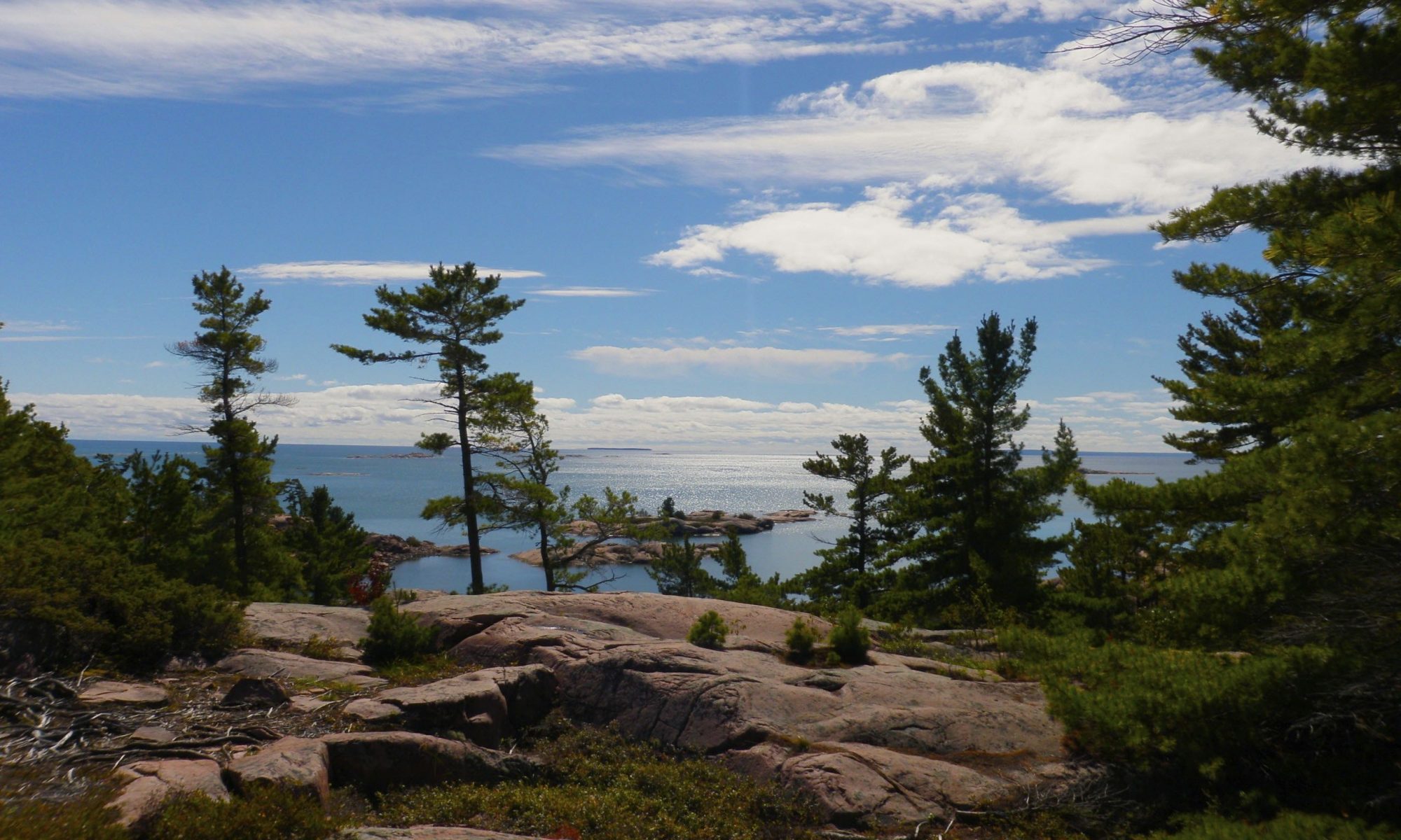
After the beach McCrae feels more like a creek than a lake, and it winds back and forth between boggy areas. There are some beaver lodges here. It’s a nice area, but it pales in comparison to what you’ll soon encounter. When you turn the last corner the lake opens up ahead. Twisted rock formations on either side frame a small rocky island. At sunset the light will catch these rocks and make them glow with a red light. It’s a really pretty spot.

It’s not a very large lake, but it’s spidery, with several bays, so navigation can be a bit tricky. There’s a large island in the middle of the lake, and in the far end of this bay are some cliffs that are popular with rock climbers.

We didn’t visit those cliffs on this trip, because we were pushing on to our destination geocache. We crossed the lake to where a small rock ledge separates McCrae from Georgian Bay. The lake tumbles over the rocks and forms a small rapid. Scenic cliffs tower on either side. It’s a really pretty spot, and the far side is a popular anchorage for cottagers on the bay who visit the area for picnics. There’s another geocache hidden here, “McCraezy on the Bay” at the top of one of the cliffs next to a lovely campsite.

In addition to the geocache there are two shrines located here. One is a small altar built into the cliff, and the second huge cross mounted high up on the same side and visible from the bay.

Georgian Bay

The next part of our trip was a very long paddle up the bay to the mouth of the Gibson River. I must say I can’t really recommend this part of the trip. Don’t get me wrong, the scenery is still amazing, but the shore is littered with cottages, and after the serenity of McCrae Lake it was kind of disappointing to struggle to paddle through waters infested with motor boats.

It took us a long time to reach the river. When we did, not only did the water calm down, there were far fewer boats and no cottages. We didn’t have long to travel up the river before we reached our destination — an old sunken logging barge. The geocache had been hidden underwater in the ruins of the barge. We found the cache and retraced our steps.

Even though the paddle through cottage country was far from being a highlight of the trip exploring the old barge was pretty neat.

Conclusion

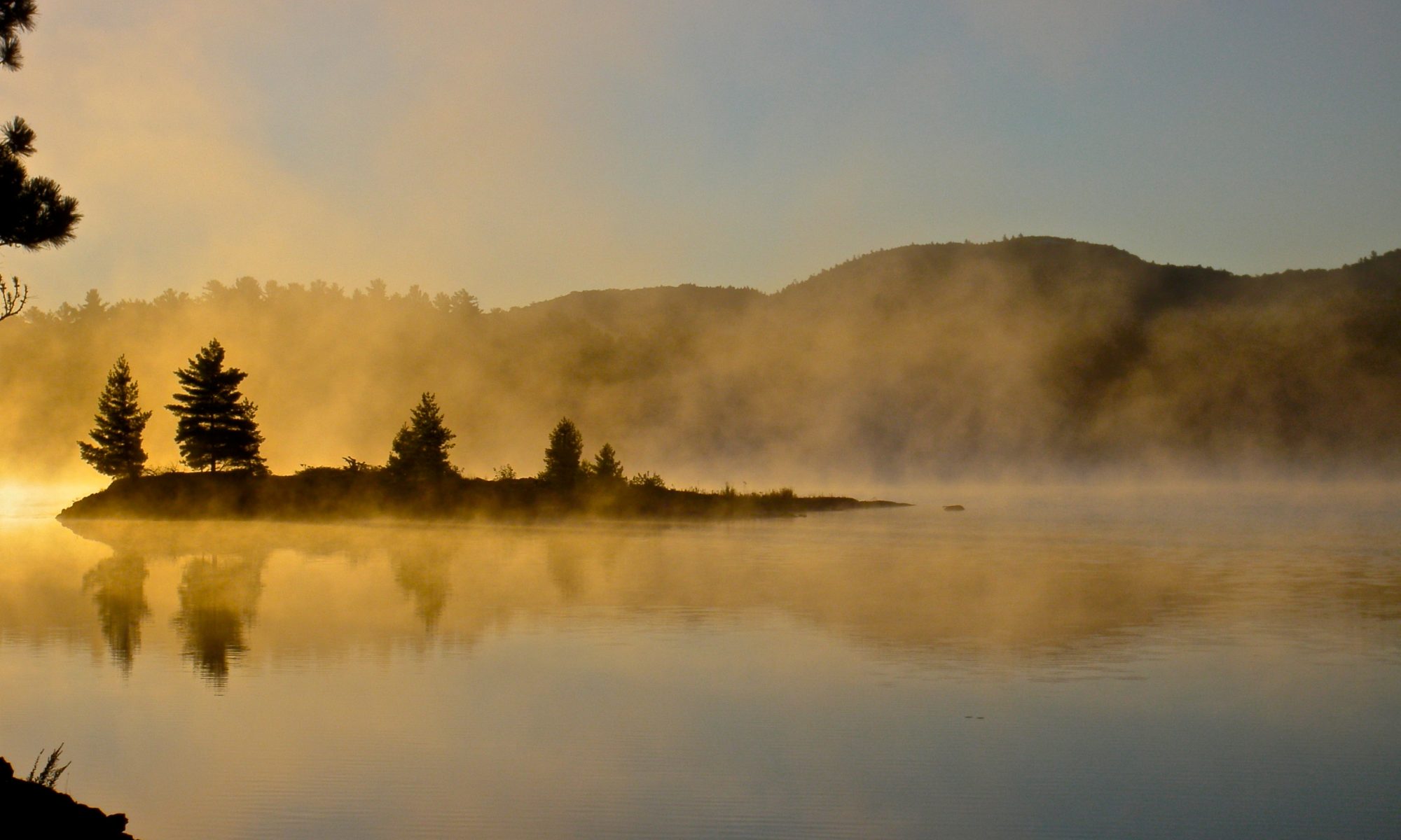
We made it back to McCrae Lake just in time to catch the sunset. It’s a pretty spectacular place to be during the golden hour. The water of the lake was calm and we paddled slowly back to the portage as we took in the scenery. We had to tie the canoe to the car in the dark, and then we took a short hike to find one last geocache, “Not Going McCraezy”.

Tips

McCrae Lake is spectacular, but I don’t know how much I’d recommend it as a camping destination. The crowds and the mess are rather unappealing. I tried to camp at McCrae once, but was advised in the parking lot that all of the good sites were taken so I went elsewhere. If you do decide to camp at McCrae I’d forgo the trip through cottage country as I felt it detracted from the experience.

Difficulty

  • This is a very easy trip. The only portage is along a well worn easy to follow trail, but the rocks can get slippery in the rain.
  • This trip can easily be done in one day, so it makes for a very easy two day camping trip.

Remoteness

  • McCrae Lake is a spectacular gem. It would be unspoiled were it not for the crowds. But the crowds are pretty bad.
  • Even though this is an ideal two day trip I wouldn’t recommend it on a weekend. Most of the sites will be taken early on Friday. If you do want to go on a weekend it’s best to start your trip early.
  • There are far less crowds in the early spring and the fall. I’ve been here on day trips in the shoulder season and it was the only time that camping seemed possible.

Chikanshing Trail

Picture

Story

The wilderness interior of Killarney Provincial Park has a very complex geology where granite ridges collide with dramatic white quartzite mountains. The south edge of the park where it is bounded by Georgian Bay is home to another intersection of rock types. Here the pink granite meets the even redder gneiss that originally helped form the LaCloche Mountains.

This area is as distinctive, unique, and beautiful as the park interior. The Chikanshing Trail is short and rugged but very scenic. It follows the creek of the same name out to Georgian Bay and then loops back further inland. The path along the water is by far the most scenic. The creek is the put in point for kayakers and canoeists wanting to circumnavigate Phillip Edward Island. We met a group of anglers returning from a multi day kayak trip when we hiked the trail.

The trail is well marked, though most of the blazes are painted on the rocks so winter travel might be difficult. In some places the blazes can be hard to spot but the trail is still easy to follow. There are also informational plaques that detail the natural, geologic and historic significance of several sights on the trail. The plaques are relatively unobtrusive but they do stand out as unnatural.

The trail isn’t long at all, nor is it particularly difficult, but there is some scrambling required in places. The rocks are twisted into complex shapes that are a strong contrast with the smooth quartzite in the park interior. Windswept trees cling to the convoluted rocks of the trail, and the view of the small islands in the bay formed by the convoluted shoreline is spectacular.

The only downside is the crowds that are attracted by the easy hike and spectacular views. Even in mid September we saw many people on the trail and the water. I can only imagine that it would be worse in the high season.

Tips

  • The terrain is moderately difficult with lots of ups and down. It’s more interesting than just a straightforward walk.
  • The scenery is a high point. This is a very beautiful hike.
  • Due to the ease of access and the proximity to the road this is a very popular hike and there can be a lot of people on the trail.

Nunikani Loop

My son and I visited the Frost centre for some camping and geocaching on the Nunikani loop. I’d read about the trip in Kevin Callan’s “A Paddler’s Guide To Cottage Country” and it seemed like a nice easy trip to close out the season.

We almost cancelled, because despite booking our site late, seemingly minutes after I made the reservation the weather report turned nasty calling for cold weather, high winds and showers. We arrived at the Big Hawk Lake marina prepared to change our plans, but finally decided to set out despite gray skies, 40 km/h winds and an intermittent drizzle.

Big Hawk And Clear Lakes

Big Hawk Lake was quite rough, but at least the wind was at our backs. In several places the canoe was literally surfing the larger waves, and there were a considerable number of white caps. My hat was blown off twice, once into the water, but I was able to grab it both times. In sharp contrast with the cold air the water was warm to the touch.

We were quite surprised to find large docks at either end of the portage into Clear Lake, serviced by an ATV. It turns out that some poor soul had planned an outside wedding on one of the rocky outcrops in the lake. The area is quite scenic, but the weather was even less suitable for a wedding than for camping.

I was a bit disappointed by the number of cottages we encountered – the shores of all lakes except for Nunikani are encrusted with cottages despite the limited road access, and small power boats and canoes are stashed along the shores in many places.

Red Pine Lake

The portage to red pine lake is quite mucky, but some strategically placed wooden planks make it easier. Callan’s book mentions two portages, but we didn’t see the second one. Red Pine Lake is also very scenic, but when we arrived the far end was clouded in rain, and the winds were fairly strong on the more open areas. We kept to the far east, skirting around the large island to find the No Jumping, No Diving geocache.

After finding the cache we paddled around the north end of the large island. The area between the islands was quite shallow, but we could see whitecaps and a strong current flowing around the north end of the lake so we stuck close to the shore of the island. The wind was still fierce, and as soon as we rounded the corner it took a lot of strength just to keep the canoe moving. We headed straight into the wind, and despite steady progress it felt like we weren’t moving at all.

We were about half way across when a motor boat made a beeline for us and asked if we were ok. Being gluttons for punishment we thanked him but waved him on, and he took off before we could change our minds.

Once we were near the west end of the lake we veered south, only to realize that the dam and portage to Nunikani were to the north. We hugged the shore to keep out of the wind and headed to the north end of the lake where we landed at the dam.

Little Nunikani

The dam was interesting to look at, and we took the portage twice – once with our gear and then again with the canoe. The first 200 – 300 meters are very easy, almost like a paved path, but then the trail gets rougher and muddier. We slipped a few times on wet roots in the rain. The first time we walked the trail we missed the put out point and hiked all the way to the end where there are some lovely rocks. On the way back I spotted the portage sign next to a particularly muddy section of trail, so we only carried the canoe that far, then we ran back to grab our paddles and paddled the boat back down to the rest of our gear.

Paddling down the Kennisis river to Nunikani was quite easy because of the current. Steam was rising off of the warm water, and as the river opened up into the lake in the setting sun we were surrounded by stumps in the water. Apparently when the dam was built it flooded the river to make the lake, so Nunikani isn’t a natural lake – the ghosts of dead forests dot it’s shores and marshes. Thankfully there were no cottages and for the first time it felt like we were in the wilderness.

It was getting dark so we headed quickly to the portage to Little Nunikani. We passed a campsite on the way in and the locals called to us and complained about the wet weather.

The portage to Little Nunikani was very short (just 30m), so we didn’t unload the canoe and hauled it underhand. It was getting dark as we paddled to our campsite (#63) on the far side of our private lake. We just had time to gather firewood and pitch our tents before dark.

Picture
Picture

We did manage to get our fire going, but never got enough heat to dry out the big logs that would have made a fire warm enough to dry us out and shake the chill out of our bones. The fire was so anemic that we had to cook our burgers and pasta on our Trangia stove. I looked up after lighting the stove and was shocked to see the sky dotted with stars smeared by the cloudy streak of the Milky Way. The clouds had parted overhead, but there was still a haze on the horizon where we could see thunderbolts flashing and hear the occasional echoing boom of thunder. After eating dinner we lay on the rocks to watch the show before doing the dishes.

Nunikani

It rained a couple of times during the night but not enough to penetrate our defences. When I woke around 7 I could see pink clouds and blue sky through the fly of my hammock. I emerged to a glorious sunny morning, but by the time I had dried out my clothes on the rocks and started breakfast the clouds had rolled back in and the rain had started.

I made a botch of breakfast by putting too much water in the mix, so we had to settle for trail mix. Just as we were packing the canoe to head back it started to rain harder and we decided to wait it out. After about 20 minutes we gave in and paddled out in the rain.

Just minutes after we had hauled our canoe through the short portage to Nunikani the rain stopped, the clouds parted and were greeted with a glorious view of this beautiful lake. We paddled slowly to savour this beautiful, wild little lake. Nunikani is small, but beautifully desolate, with no cottages. We did spot some motor boats stashed among the trees, but none of them were on the water.

At the dam we found the Nunikani cache, and then after taking some photos portaged the boat to the bottom of the rapids. The rapids here are very violent and make for an impressive sight.

Big Hawk Cliffs

The river gave us a push again until we we reached a set of very small rapids that wasn’t on my map. Instead of shooting them we opted to carry the canoe, loaded with gear over the rocks. The shore of the river here is dotted with large stumps that have washed ashore, presumably from Nunikani above the dam.

We rounded the final bend of the river to see the tall cliffs that were once rumoured to contain a native gold mine. Nowhere else do the gravely beaches and rugged shores of Nunikani evoke the valleys of the rockies in BC more. We paddled slowly down this majestic pass, only using our paddles to guide the canoe. Even the tiny cottages that dot the base of the cliffs don’t detract from their impact.

Log Chute

Once we were back on Big Hawk Lake we had a very vigorous paddle to round the point to the marina. The wind had died considerably since the day before, but paddling against it was difficult even for such a brief stretch so we stuck very close to shore. Once we were in the bay leading to the marina it was a relatively easy paddle to the beach.

After we tied the canoe to the car we stopped to visit the last log chute in Ontario (and failed to find the cache there) before starting the long drive home.

As promised in Callan’s book Nunikani is a very scenic trip, and under normal conditions would be quite easy. The heavy winds did make some of the paddling more challenging, but still attainable for a determined novice. My only disappointment other than the weather was the number of cottages that dotted the sore of all of the lakes that we visited with the exception of Nunikani.

Tips

The Haliburton Highlands Water Trails are a managed camping area and require a reservation for overnight camping. They have an excellent website for online reservations. Campsites are booked individually rather than by the lake so you know you know that your site will be available if you arrive late.

Difficulty

  • This is a short trip and the longest portage is only 440m.
  • We had a tough paddle on Red Pine Lake, but I don’t think that was just bad luck.
  • The trip can be easily completed in two days.

Comfort

  • I visited in the late summer and so understandably there were no bugs. I don’t really know how bad they’d be in the spring.
  • The high cliffs on Big Hawk Lake make for some spectacular views which are a bit above other routes in the area.

Remoteness

  • There are a lot of cottages on Big Hawk Lake and several more on Clear Lake and Red Pine Lake. The only lake that feels like wilderness is Nunikani and it has large dams at either end.
  • The weather and the season conspired to keep the crowds away on our trip, but we still saw quite a few people. Even if you manage to avoid other campers it’s quite likely that the cottager traffic will be quite high.

Narrow Escape

Story

Muskoka is known for rugged beauty, but not particularly for unspoiled wilderness. There are a few lakes whose shores aren’t encrusted with cottages and constantly patrolled by buzzing motorboats however. One of the largest such areas is along the course of the Gibson River.

I invited some co-workers to come for a late September canoe trip in order to find some Geocaches. Planning isn’t my strong suit, and late September turned into mid October before we headed out.

There were four of us, and the usual complexities coordinating a group of people landed us on a date with a less than stellar weather forecast, calling for 10 – 20mm of rain. Hours before our departure Environment Canada posted an extreme weather advisory calling for 45 – 50mm of rain. Oddly enough the forecast continued to predict only 10 – 20mm. The temperature was warm, the winds low, and the plans made, so we decided to press on despite the alert. The rain proved annoying, but not extreme.

I thought that the rain would mean that we were the only paddlers on the water, but we saw a lone kayaker putting in at the marina and we encountered a large group of 10 – 12 canoes paddling out on Nine Mile Lake. They had been camping on Turtle Lake since Friday night. They must have had a very cold and wet trip. Nine Mile Lake was the only part of our trip where we saw cottages, and the portage to Turtle Lake is just around the bend from the last of the houses. Once we got off of Nine Mile Lake we were completely alone, and the only sound of civilization was a train (the tracks cut right through the area we were paddling, but we didn’t make it far enough to see them). There were some boats stashed at the end of the Turtle Lake portage, but other than the blazed trails themselves and the occasional campsite the illusion of being deep in the backcountry was perfect.

The portage was a bit wet. In fact there was a waterfall right down the middle of the trail! The portage only went as far as the marsh on the maps, and I’d hoped we’d be able to paddle the bulk of it, but the marsh was far too dry so we had to do a 500m carry. There were several large (and cold) puddles on the trail that could be avoided with some extra effort, but I was already so wet I finally just decided to walk through them. Other than the water the portage was quite easy, but the trail isn’t as wide and worn as one you’d find in a large well maintained park like Killarney.

All of the lakes were well sheltered from the wind, if not the rain, and the paddle down Turtle Lake was easy. Turtle Lake is a good example of Canadian shield terrain, but not particularly remarkable in any way until you reach the south end. There it hooks West as it funnels between rock faces on both sides. There are a lot of standing dead trees in the water here, but the water is quite deep so it’s fairly easy to paddle between them. It’s a scenic little channel. There were a couple of places where I wasn’t sure where to turn, but we found the right path without much difficulty.

The beaver dam at the end of the channel isn’t particularly long, but it’s height is quite impressive. It’s constructed as a pair of arches braced against a small rock island in the middle to hold back the large volume of water.. The water on the upstream side of the dam is quite deep and was noticeably colder than in other parts of the lake. There must be several generations of beaver families who’ve worked on this dam. Unfortunately I didn’t manage to get a picture that shows off the height of the structure.

The remaining distance to Brotherson’s Lake is a short 200m portage, but just like the water it drops quite abruptly at the end. The shore of Brotherson’s Lake is ringed by small cliffs because it’s so much lower than the surrounding terrain. It makes the lake a little more scenic than Turtle Lake on the other side of the hill.

After a short paddle on Brotherson’s Lake we came to the channel that connects it to Narrow Lake. The channel was navigable without having to line the canoe, but just. Most of the channel is a mud flat covered by a few inches of water, but the current has carved a deeper passage that winds through the middle. The deeper channel is actually visible on the Bing Maps satellite photos (a cloud obscures the channel with the current Google Maps imagery). On our way into Narrow Lake it was pretty easy to see the deeper channel from the stern, but on the way out the rain had started again and covered the surface of the water with ripples which made navigation more difficult.

Our final destination was Narrow Lake, and we were only out for a day trip, so once there we turned around and headed back. We switched up the portaging duties on the way out, and also let some of the other members in our group try paddling from the stern. We made it back to the marina just after dark, but we had cleared all of the portages by the time the sun set.

Tips

There’s pay parking and free parking at the marina. Your choice pending availability.

Other than the remoteness this is a fairly easy trip. There are many other trips that can be had in the area, and being a little more wild than a developed park it’s fun to explore. Just make sure that you’re prepared with a good map and leave yourself some extra time since the trails aren’t rigorously maintained.

If you intend to camp we did see several posted sites with fire pits but I have no idea if they also have thunder boxes, or if they are maintained at all. Of greater importance I have no idea how busy they get, so I don’t know how hard it would be to find a site in high season.

McEwan Lake Loop

I had been hoping to do a few short solo camping trips this year, but for some reason all of the weekends filled up very early and it wasn’t until June that I finally had a chance. When planning an impromptu trip the Haliburton Highlands are much more forgiving than the large provincial parks, and for short trips offer a very similar experience.

Yet again I consulted Kevin Callan’s “A Paddler’s Guide To Cottage Country” for trip planning. This year I selected the McEwan Lake loop, and chose the Wren Lake access to the North. I did decide to modify the route slightly by eliminating the loop at the south end. First, I’m lazy, and didn’t think I’d enjoy the 664m portage between Margaret and Three Island Lakes with my heavy fibreglass canoe. Second, the map at the access point showed one or two cottages on Margaret Lake. Finding a cottage at the midpoint of the trip would spoil the spell a bit so I decided not to risk it. Since I didn’t visit Margaret Lake on this trip I have no idea how built up it is.

Day One

The Wren Lake access point is just a parking lot off the highway, but it is a fairly built up area with lots of cottages. The trip actually starts with a paddle under highway 35, and Wren Lake is ringed by cottages. The cottages end before the falls at the West end of the lake, but there were a couple of girls sunning themselves on the rocks at the lift over when I arrived. I’m not really sure how they got there since they didn’t have a canoe so there must be a trail.

The lift over is quite easy because it’s over solid rock and then a very short paddle and an equally short and easy portage down the small falls led me to a much more remote marsh. Once below the falls I felt like I’d left cottage country and was in a much wilder area. The stream winds its way through the marsh to a slightly more difficult portage at the other end. There’s a small bridge there for an ATV or snowmobile trail, and the trail system does get a bit confusing on the portage so I hiked a bit of it without the pack and canoe to make sure I was going the right way later.

The next portage is the tough one, and I was dreading it a bit. It’s only 228m long, but it’s almost straight uphill. In Callan’s book he mentions that it’s the watershed between Georgian Bay and the Severn river system. The takeout was a muddy mess, and as advertised the hill goes almost straight up. I didn’t even try to do a single carry, I just went in stages going back and forth for my pack and the canoe.

Horse Lake was worth the climb as it is quite pretty. I enjoyed a leisurely paddle, followed by an unremarkable portage to Margaret Lake. My campsite was in view from the portage, and I had the whole lake to myself. By the time dinner was cooked and hung and the fire lit,

the sun had set and I had to beat a hasty retreat to my hammock to escape the mosquitoes. It gets nasty after dark!

Day Two

I stayed up reading pretty late, and then woke up distressingly early. I had to pee, but I didn’t want to leave the protection of my hammock because I could still hear the mosquitoes buzzing. Trying to sleep when you have to pee is pretty futile, so I swung back and forth restlessly.

That’s when I first heard the banging. It sounded like a paddle on the gunnel of a canoe, but it was quite loud and close. I peered out from under my fly to see if I could see a light but there was nobody on the lake at four in the morning. I had finally decided that I must have imagined the sound when I heard it again. It repeated several times at irregular intervals. Whenever I thought it was done it would start up again.

I was beginning to wonder if it was a porcupine chewing on one of my paddles, which would upset me considerably. I yelled to scare off whatever it was but it didn’t work, and the thumping continued. Between the pressure in my bladder, the buzzing bugs, and the banging sound I didn’t manage to get back to sleep. After about an hour the sky was starting to lighten, the banging hadn’t stopped and I still wasn’t sleeping so I decided to run through the bugs, have a quick pee, scare off whatever was after my paddles and get back to bed.

It turns out that the only remaining mosquitoes were all clustered around my hammock and in just a few steps I was free of them. Imagine my surprise when I looked under my canoe and saw a large snapping turtle peeking out from under the bow!

I was taking a few pictures when I heard a sound behind me. I turned just in time to see another snapper jump off the rocks into the water below. It was only a few minutes later when I found a third digging a hole only a meter from the fire pit. Apparently my campsite was a nesting ground for snappers! The turtle who jumped was watching me from the water, and the other two were eyeing me carefully and hissing whenever I approached.

After snapping some more photos I turned around to spot another large snapper crawling though the rocks I was using as a kitchen. I’m not sure if this was a fourth or if the second had come back around, but this turtle was coming from the direction of my hammock, not the water.

After my pee break I completely forgot about getting back to bed so I set about making some oatmeal. By the time I was done the turtles had started to ignore me and I could watch them clamber clumsily over the rocks as I ate my goo.

Mucky Portage

I had an ulterior motive for choosing this destination for my trip. A few years ago while on a winter hike some of the other people I was with hid a geocache on Three Island Lake. Not wanting to log a find on a cache I had essentially hidden I promised to come back one day to claim my smiley. I hung my food and left my big pack at the site and portaged over to Three Island Lake. There was another solo camper there and she was packing up before heading out.

For some reason a seagull on a nearby rock ignored me completely on the way in, but got quite irate when I was leaving and even took to dive bombing me (complete with gooey projectiles). Strange creature encounters that morning. It didn’t take long to find the cache but by the time I was back at my campsite the turtles were all gone. They had left some poorly covered (and broken) eggshells. Hopefully they’ll find a more appropriate place to lay their eggs in the future. I packed up and retraced my route from the first day. It was a thoroughly enjoyable short trip, but I was pretty tired on the drive home thanks to the lack of sleep!

Tips

The Haliburton Highlands Water Trails are a managed camping area and require a reservation for overnight camping. They have an excellent website for online reservations. Campsites are booked individually rather than by the lake so you know you know that your site will be available if you arrive late.

Difficulty

  • This is a very short trip and the longest portage is 664m. I cut that one off. The Horse Lake portage is a bit steep but other than the grade the terrain isn’t very difficult.
  • There are some swifts below the ATV bridge but they can be easily be portaged around.
  • The trip can be easily completed in two days, or even done as a day trip with an early start.

Comfort

This is an area that gets particularly buggy in the spring.

Remoteness

  • There are lots of cottages on Wren Lake, possibly one or two on Margaret Lake, and a bridge for an ATV trail crosses the route but other than that it is quite undeveloped. If you go looking for it you can find a ski warm up hut on Three Island Lake, but it isn’t visible from the water.
  • The route isn’t heavily trafficked and there aren’t many campsites on each lake. One nice thing about Haliburton Highlands is that you can book close to your departure date and the online system lets you see which other sites nearby are booked so you can avoid crowds.

Gun Lake Solo Canoe Trip

I chose this trip as my first solo canoe trip because I wanted a destination that was close to home, not too challenging, but still scenic. The Herb & Gun Lake Loop described in Kevin Callan’s “A Paddler’s Guid To Cottage Country” seemed ideal. None of the portages were long or difficult and it would give me a chance to find a few geocaches on the way.

First Day

Even after driving from Stouffville to Dorset and stopping for a hearty lunch I still had more than enough time to make it to my campsite before nightfall. There was a bit of a breeze when I started and I had to do some vigorous paddling to get going, but the wind soon cooperated and by the time I sailed past the last of the cottages near the put in point I was moving along easily. It was one of those bright sunny days that just overwhelms you with the beauty of the area, warm, but not hot.

Half way along Herb Lake I paddled past a campsite populated by young women in bikinis. I tried not to gawk so as to give them their privacy, but they called out happy helloes and I waved back. It was a long and slightly awkward paddle across the bay in front of their site.

The narrows at the south end of Herb is very scenic. The water level was high enough that the small dam between Herb and Ernest Lakes was awash and I didn’t have to do a lift over, just a shimmy. The Ernst to Brandy portage is quite flat except for a sudden drop at the end. It’s a very easy carry and I was able to manage my pack and canoe at the same time.

The lift over in the middle of the pond was the only one that required me to get out of the canoe. After sliding the canoe over (and getting a soaker) I was starting to wonder if I’d missed the portage. It’s a good thing that I was looking for the sign because I almost went right past it to the falls. The Brandy Falls portage is very scenic where the stream tips over the rocks between the two lakes.

The water winds back and forth through some reeds before opening out onto Gunn Lake. It may have been the perfect weather, or the sun glinting off the water, but Gunn Lake seemed like an ideal spot to be at the time. The pictures on the HHWT websites often don’t do the campsites justice and make the place look a bit dull, but on this bright September day Gunn Lake was truly spectacular.

Even after a late start thanks to the drive, I got to my site by four o’clock and still had plenty of time to make camp, cook dinner and wash up before sunset. With all of my chores done I was able to relax and read my book. I hadn’t been thrilled with my site at first, but it really grew on me as I enjoyed the view of the bay and watched the full moon rise over this pretty little lake. The local beaver had a lodge nearby and was patrolling the bay next to my site, diving frequently with a loud slap of the tail.

I had been a bit worried about sleeping in my hammock in the cool September night, but other than a small draft on my bum I was quite comfortable, and the chill in the air kept all of the bugs away.

Second Day

Reversing my route back to Herb Lake was quite easy. Not only was the weather still perfect, but the wind had obligingly reversed itself so I was paddling with the breeze again. I met some Kayakers at the end of the Herb portage and we chatted briefly about the park and camping in the area.

I took a detour to Knife Lake on the way out to grab a geocache. Since I wasn’t going to camp I didn’t need to bring my pack and made quick work of the first portage. The water between the two lakes is very scenic and deserving of a loftier title than ‘pond’. I think of ponds as overgrown marshy puddles, not scenic pools shadowed by majestic granite hills.

The first portage looked much shorter than the second on my map, but still neither was really of any consequence. When I started the second the sign said 141m, so I was kind of surprised when I saw the water ahead after just a few steps. I checked the sign on Knife Lake, and it too said 141m, but I suspect that someone added a 100m to the length of this short walk on the signs.

When I paddled back through the Herb the girls in their bikinis were gone and I had a quiet paddle back to my car. A loon surfaced right next to my canoe just as I was in view of the takeout point. I still had time to visit the fire tower in Dorset before driving home.

Tips

The Haliburton Highlands Water Trails are a managed camping area and require a reservation for overnight camping. The have an excellent website for online reservations. Campsites are booked individually rather than by the lake so you know you know that your site will be available if you arrive late.

Difficulty

  • All of the portages are flat, relatively level and mercifully short.
  • There are one or two lift overs depending on water levels, neither of which are very difficult.
  • The trip can be easily completed in two days, or even done as a day trip with an early start.

Comfort

The area isn’t particularly marshy or boggy, but I would expect there to be quite a few bugs in the late spring, early summer.

Remoteness

  • There are a few cottages on Herb Lake near the put in point, but it doesn’t take long to leave them behind. I saw a much more rustic looking hunt camp on Knife Lake. While the cottages mean that it isn’t a full backcountry experience they were out of the way.
  • I did see an aluminum fishing boat at the end of the portage to Gun Lake, so it is possible to encounter powerboats on any of the lakes. I didn’t on my trip but in peak season it is probably quite likely.
  • While I didn’t experience much traffic on my trip I expect that in the peak season it gets pretty busy and potentially a bit rowdy. The lack of portages for the Herb Lake sites would be very appealing to partiers, and Gun Lake isn’t much harder to get to.

O.S.A. Lake Canoe Trip, 2012

O.S.A. Lake is the birthplace of Killarney Provincial park, and arguably one of the nicest lakes in the park. It’s also a very short trip from the George Lake campground and thus is one of the most popular destinations. Because of the incredible scenery and easy access it makes an excellent destination for a novice weekend trip. It’s not a particularly large lake, but because there are only five campsites it never feels crowded. This all comes with a  price, however. Since it’s so popular you’ll have to book far in advance in order to secure a place on this lovely little lake.

I’ve visited O.S.A. Lake on several of my longer canoe trips, but I wanted to share its charm with my wife, so we planned an early fall canoe trip. We camped in the car campground before and after the canoe trip, so our planning involved a pile of different permits. We spent a week in the area, but this was by far the highlight of the trip.

Day 1: George Lake — O.S.A. Lake

We had to move our car from our campsite at George Lake campground to the overnight parking, but first we dropped our gear off at the top of the stairs that lead down to the beach. In the summer this area can become pretty crowded so you have to be organized and drop your gear quickly, but it wasn’t any trouble at all for us this late in the season.

The beach at George Lake is situated in a small bay on the southern part of the lake. This side of the lake is formed from pink granite, but the narrows that leads to the rest of the lake frames a view of the white quartzite hills that form the north shore of the lake. Once you paddle through this gap you can see the entirety of the lake, with white quartzite hills on the north shore and pink granite on the south. It’s not a large lake, but it’s very pretty. Paddling can be a bit of a chore if the wind is up, but we had perfect conditions.

At the far end of the lake is the portage to Freeland Lake. The portage is very short, but also very pretty. It skirts around a dam that holds back the waters of Freeland Lake. Originally a beaver dam it has been made more permanent. The park staff have erected a wooden dock at the portage to make the take out easier. I’m not sure how necessary the dock is, but it does make finding the portage easier. After carrying your canoe 45 meters up a small hill you place it off to one side while you return to get your packs. This portage can get very busy in the summer so it’s important to keep your gear together so you don’t lose anything and ensure that it’s out of everyone else’s way.

The only other people on the portage on our trip were a young couple that had set out from George Lake at the same time that we did. They were furiously unpacking their gear because their can of bear spray had gone off inside of their pack. I’ve never bothered with bear spray, so I’m not really sure what kind of mess it makes, but I gather it isn’t pleasant.

Two trees frame the view of Freeland Lake at the far end of the portage, making a perfect picture of this pretty, marshy little lake. Most of the lakes in Killarney are dead with pristine clear water but Freeland is shallow, boggy and choked with life. It feels much more like Algonquin than Killarney. You’ll have to stick to the centre as you paddle down the lake to avoid thick lily pads and bog mats.

The take out for the portage to Killarney Lake is on the north east shore of Freeland. There’s no dock here but it’s well signed and there’s a bit of a sandy beach. The portage is a bit longer and travels through some thicker trees, but it’s still very easy. The whole trip is over smooth rock and well worn firm ground. If it’s early in the season you can explore the rocky swifts to the east of the portage. This creek usually dries up later in the season. It’s nothing spectacular but it is some interesting rocky terrain.

The Killarney end of the portage lies on a rock shelf at the end of small channel. The water is littered with logs, and barren white standing dead trees line the shore. Just visible past the first narrows are the white hills that surround Killarney Lake. This end of the lake is spidery and winds back and forth, each new bend revealing an even more dramatic view of the hills that soon loom over you. It’s a spectacular introduction to the lake, but it can be a bit challenging to navigate. There are plenty of places for a directionally challenged traveller to make a wrong turn and get lost in here, so make sure that you consult your map to prevent having to backtrack.

The goal is to follow the bays and channels into the south end of the lake proper, and then paddle west at the foot of the white hills. When the lake starts to turn to the south you’ve reached the portage to O.S.A. Lake. This corner of Killarney Lake is home to many dead stumps, but it’s still easy to travel. Finding the portage can be a bit tricky as the sign is far back on shore where the tree line begins. There are actually two portages between the lakes. The second one is much shorter, but I’ve never had the good fortune to use it. The water level has to be high enough to paddle the far end of the lake. The first portage is so flat and easy that I usually don’t bother trying to get to the second one any more.

The far end is a rocky beach where the waves have ground the stone into gravel. The one challenge on O.S.A. Lake is that the winds can be funnelled down the length of the lake making paddling difficult as you search for a campsite. The sites at the north west end of the lake offer the best views. Our only challenge with the crowding on O.S.A Lake was finding a campsite. I was hoping to get one of the island campsites, but they were already taken.

We chose the site at the base of a tall cliff at the north west end of the lake. As we reached the shore we spotted another canoe heading in the same direction. They continued on for a few minutes, but when it became clear that we were moving in they turned away. We’d beat them to the site by only fifteen minutes! The campsite is a bit secluded in the trees, but if you venture out to the rocky beach it has a spectacular view of the hills to the south. Even if it wasn’t the site that we wanted we felt pretty lucky to have nabbed such a nice spot.

Day 2: O.S.A. Lake Ridge Running

The white quartzite hills of Killarney are rather sparsely treed. Not only has the area has been logged in the past, larger trees have a hard time growing in the thin soil on top of the quartzite. This means that the woods aren’t particularly thick and it’s very easy to bushwhack along the white ridges where clear views of the lakes are plentiful. My first experience with Killarney ridge running was when I found the geocache perched high up above the north shore of O.S.A. Lake. I persuaded Sherri to return to this spectacular spot with me.

One of the fun parts about Killarney ridge running is the navigation. The geocache is situated at the top of a tall shear cliff, but by examining the map an obvious path up to the cache can be found in the form of a swale cut by a stream as it tumbles down the hill. It’s a relatively easy hike, but once you get clear of the trees it offers spectacular views of the lake below, and the tall hill behind as well.

The cache is hidden near the site of a photo that was used in park literature, and is still posted on a sign on the beach at George Lake. The cache owner playfully requests that finders try to recreate the photo. I had done so the last time I found the cache with Xander, but it was a bit more difficult with Sherri. We had great weather for the three days of our trip, but it was a bit windy at the top, and my wife is leery of, if not afraid of, heights. I did manage to persuade her to crawl out to the edge to pose for the famous picture, even if the sun wouldn’t come out.

After finding the cache we returned to our canoe at the base of the cliff and paddled back to our campsite. We enjoyed another spectacular sunset. One of the reasons that O.S.A. is such a pretty lake, is that it’s orientation is aligned with the track of the sun in the summer, so the sun is visible until moments before it sets at certain times of the year.

Day 3: O.S.A. Lake — George Lake

We were emjoying such nice weather that it was hard to leave, but not only did we not have a reservation, we had some appointments booked and had to get back. On the way out we visited an old trapper’s cabin on one of the islands. The cabin collapsed long ago, but the ruins still make for an interesting place to explore. After visiting the cabin we retraced our route to return to our car.

Tips

Difficulty

  • All of the portages are flat, relatively level and mercifully short.
  • The trip can be easily completed in two days, or even done as a day trip with an early start. But if you have time it’s worth it to book an extra day or two to enjoy the area.
  • Paddling on O.S.A., Killarney and George Lakes can be difficult if the wind picks up. All three lakes funnel the wind. Normally it’s pretty easy going, but if the wind picks up you will need to work to stay on course.
  • The hardest thing about this trip may be booking it. You can book trips in Killarney starting five months to the day before the start of your trip. If you want to get a site on O.S.A. Lake you’ll almost certainly have to book as early as possible.
  • If you can’t book a site on O.S.A. Lake you can try to shorten the trip and stop on Killarney Lake.

Comfort

Apparently Killarney can get pretty buggy in the spring, but I’ve still never experienced it. In late summer or fall there are almost never any bugs. The only significant wetland on this route is through Freeland Lake, so there are very few areas for bugs to breed.

Remoteness

  • This is a very easy trip with incredible rewards. As such it’s very popular. Not only is it hard to book the trip you may have to race to get a campsite on O.S.A. Lake.
  • O.S.A. Lake is also a major corridor for several of the longer trips in the park. It is quite likely that you will see several flotillas of canoes passing through each day.
  • Once you actually have a site they’re well spaced so there’s a lot of privacy . There are only five campsites on the whole lake. I’ve often been able to hear some of my neighbours here, but I’ve rarely seen them (I believe that two of the sites are quire close to one another, but I’ve stayed at one of them and never saw my neighbours).

Mizzy Lake Trail

Story

Located just down the highway from the Canoe Lake access point and heading into the bush in the general direction of the Arrowhon Pines Resort, the Mizzy Lake trail isn’t in the most remote part of Algonquin Park. On the other hand, at twelve kilometres in length it’s one of the longer trails accessible from the highway 60 corridor, and the theme of the interpretative guide is wildlife viewing so it makes a good day hike destination.

The trail typically takes four to five hours to complete, so we left Stouffville at six AM. The weather forecast was calling for clear blue skies, but the sudden change in the temperature had blocked the sky as the snow sublimated to fog. The fog hung in for most of the two and half hour drive before it burned off quite suddenly just as we entered the park. We were greeted to some spectacular views of the last tendrils of mist clinging to the hills around the lakes.

There were some delays stopping at Algonquin Outfitters to get some snowshoes and picking up our permit at the park gate, and then we had a warm up hike on the short but scenic lookout trail, so we didn’t get onto the Mizzy Lake Trail until a little after one.

Mizzy Lake Section

The first section of trail is in moderately easy terrain but rugged. The rolling hills of Algonquin provide a nice backdrop to the many small lakes, ponds and marshes that the trail cuts through. There are boardwalks and bridges wherever the trail crosses the water, and these are more than adequate for keeping feet dry in the winter, but I’ve heard that some sections can be muddy in the spring and summer. The trail had seen enough recent traffic that the snow was well packed down. Snowshoes weren’t mandatory but they did help with traction in several places.

I had been wondering if the ‘wilderness’ aspect of the trail was just a theme for the trail guide, or if we’d actually get a chance to encounter some wildlife. After all we were bounded by the highway to the south, Arrowhon road to the west, the rail trail to the east and Arrowhon Pines itself was to the north.

We didn’t encounter any large animals, but not long after we passed Mizzy Lake we did make an interesting discovery. I was looking at the ground in front of me when I realized that some of the tracks weren’t human. Deer tracks are quite common near trails, but a brief inspection revealed that these belonged to a moose that had followed the trail quite recently. We had missed where the moose got onto the trail, but after following the tracks for a few hundred meters we saw where it left. This was the first of several sets of moose tracks we encountered and at once point we saw some coarse black hair that had been shed.

Rail Trail Section

Not long after Mizzy Lake the trail merges with the bed of an old rail line. Rail trails can be notoriously dull, but this one is fairly nice even if the terrain isn’t particularly rugged. The rail line cuts right across several small ponds on earthen dikes. While the intrusion of the trail on the ponds is a bit unsightly it did give us some great opportunities to see animal tracks on the ice. There were a surprising number of tracks considering how close we were to such a heavily trafficked trail, and we spent some time discussing the various creatures that must have made them.

It was on the rail trail section that we had our most interesting encounter. A pair of very bold and plump grey jays landed in a tree nearby and started chattering at us. We were quite surprised by how close they approached, and while snapping some photos Mike noticed that they had both been tagged with several rings around their ankles. I didn’t realize that grey jays had such a reputation for boldness and figured that the birds were used to human contact because of the tagging.

We left the birds behind, but they caught up to us again on Wolf Howl Pond while we were having a snack. The birds were nattering at me so I held out a handful of trail mix and was quite surprised when one of the jays flew over and landed on my fingers to sample my GORP. Far from being ‘wild’ the birds were quite tame! If only the moose had been so forthcoming.

We took several pictures of the birds landing on our hands before we pressed on, and they followed us to the next section of trail before they realized we weren’t giving out any more handouts.

Bear Nests

There’s a side trail that heads into a beech tree grove where bears frequently climb the trees to get at the beech nuts. As the bears climb they break small branches causing them to be packed together and form ‘nests’. Unfortunately when we got to the side trail there was a note posted by park staff explaining that there were currently no bear nests so we decided to forego the side excursion and keep to the main trail.

Return Section

After Wolf Howl Pond the trail leaves the rail bed and returns to the bush.  This section of trail is much more close and interesting and slightly more challenging than the Mizzy Lake section. The scenery is classic Canadian Shield, lots of rocks and trees interspersed by small ponds and lakes. This is the longest section of trail, and the most interesting and scenic, but there’s not much to say about our return hike through this pleasant area.

The sun was starting to set by the time we got to Dizzy Lake, and we had just enough light to make it back to the parking lot before dusk.

Tips

  • You’ll need to obtain a permit at the park gate in order to park at the trailhead.
  • Snowshoes can be rented from Algonquin Outfitters on Oxtongue Lake.
  • The trail is long enough that you have to ensure you have time to complete it before the end of the day.
  • The trail is fairly busy. We met three other hikers on our walk. In the winter this increases the chances that the snow is packed down, but it probably also reduces the chances of seeing wildlife.
  • Some sections of the trail are reportedly muddy in the warmer seasons.