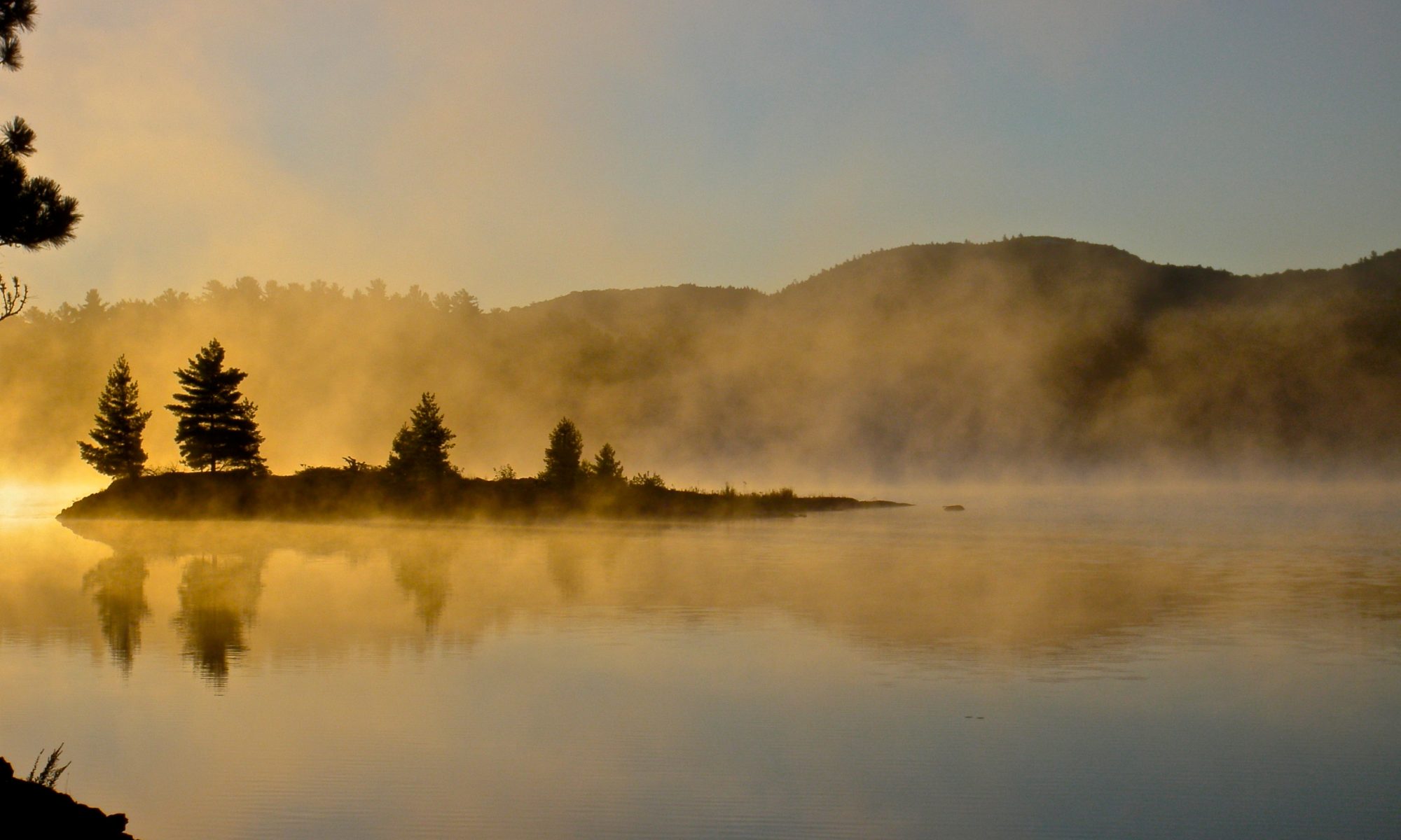
I’ve wanted to attempt the Killarney Boundary Loop since I first read about it. In his guide book Kevin Callan calls it “the essence of Killarney” and “the ultimate Killarney trip”. He also warns that it’s an extremely difficult trip, not to be taken on by the novice. Perhaps I took his warning a little too seriously because I spent over five years slowly extending the length of my trips in Killarney before attempting the loop. But I finally got to where I thought I was ready for the longest and most difficult canoe trip that I’ve attempted.
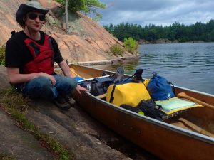
Our camping trip last year didn’t fell through due to an unfortunate intrusion of the realities of the outside world. This year I was a bit worried that the same thing would happen again and didn’t set about booking until the last minute. (Booking a canoe trip in Killarney at the ‘last minute’ means five months to the minute before the first day of your trip. That’s the earliest that you’re allowed to book). The first day I tried to book everything was already filled up. When booking a trip this long it’s usually easy after the first few days, but getting those first days sorted out you have to compete with all of the campers doing weekend trips. I waited for the next morning, woke up early and tried again. This time we managed to get every lake we wanted, even if starting on a Saturday meant I had to take an extra day off work to drive to Sudbury and it was a bit later in the season that I had hoped. Late season camping trips are great for not having any bugs, but it can be a bit cold, particularly when you sleep in a hammock.
We set out from George Lake on a pretty grey day. There were a fair amount of people at the George Lake campground, many of them getting ready for canoe trips of their own, everything from day trips to those circumnavigating the entire park. Despite the gloomy weather it was pretty exciting to be setting out, so we kept our spirits up. We passed several other canoeists on George Lake, and then a few more on the short but pretty portage to Freeland Lake, but after that we were on our own until we got to Carlyle Lake.
George is a beautiful lake, and a great introduction to the park. Large white quartzite cliffs meet pink granite in an epic display of geology. Freeland, atypical of Killarney, is teeming with life, marshy, and devoid of spectacular rock forms. It’s still a very pretty lake, and it lead us to our first challenge of the trip.
At the far end of Freeland is a creek that winds it’s way to Kakakise Lake. When the water is low this creek isn’t navigable, so there’s a 1700m portage to bypass it. It had been a pretty dry summer so I checked with park staff before we headed out and was assured that the creek was passable. I’d never travelled this way before, so I didn’t know what to expect, and I was a bit worried that perhaps we’d been led astray. It wasn’t particularly difficult, but it also didn’t seem like anyone had come this way in a while. If we were going the wrong way turning around and heading back would be a lot of work. The creek is littered with small beaver dams. We were travelling against the current, so each one meant a lift over where we were hauling the canoe uphill. None of them were very tall, except perhaps the last one we encountered. This led us into a pretty little marsh that wound past a large rock on the left. After that our last lift-over was where the bridge for the Silhouette Trail crosses the creek.
Paddling across Kakakise was a bit of a relief after winding through the creek. I’ve hiked past Kakakise a few times, but I’ve never paddled it. I must admit I’ve never been particularly enchanted by the lake, but I’ve only seen one end. It is nicer as you proceed east.
One of many lift overs we encountered along the creek.
The rain had just started as we left Kakakise Lake.
It took us a little while to find the 860m portage to Carlyle Lake. This was our only portage of any significance of the day, and was our heaviest portage of the trip since we hadn’t eaten any food yet. It’s a bit steep at the takeout, but after that it’s pretty flat. There’s a fairly extensive boardwalk along part of the portage where it must get muddy at times. It had started to spit lightly while we were on Kakakise, but I had a canoe hat to keep me dry before the rain got heavy. By the time we were paddling on Carlyle Lake the rain had slowed down again.
There’s a very interesting looking campsite on the tiny ridge that separates Carlyle and Terry Lakes. A waterfall runs through it as Terry empties into Carlyle. Unfortunately this site was occupied so we took the one directly across the bay. I didn’t want to press on too far into Carlyle since it’s an access lake and I knew we’d start to see cottages if we continued. We could hear the waterfall at the other campsite gurgling away all night long.
The rain was off and on so we set our tarp up over the fire pit. This gave us a place to sit while we ate, and then after dinner we had a small fire under the tarp. The previous tenants had left us plenty of firewood so we didn’t have to go looking in the dark.
It was at dinner that I had the first hint that we may have brought to much food. Alex hadn’t eaten his ration of GORP and Cliff Bars yet, so he had to eat two meals at once, and it was obviously difficult getting them both down. I was hoping that it was only because we’d had such a large breakfast that morning. We had almost fifty pounds of food, and what we didn’t eat we’d have to carry on the long difficult portages in the middle of the trip.
The next morning was sunny and beautiful, which was a relief after the gloomy rain the day before. I was in a bit of a hurry in the morning since I’d heard that the wind could be a problem on Johnnie and Carlyle Lakes. My worries proved unfounded – other than a stretch where Crooked Lake twists around we had the wind at our backs all morning. We were heading straight for David Lake, rather than following the boundary of the park to the north east. While the latter route is more true to the ‘boundary’ it seems to me like the detour only serves to lengthen the trip since it leads away from the LaCloche hills that are the centrepiece of Killarney.
It didn’t take us long to see our first cottages as we skirted the edge of the park. We even passed a motorboat where a young couple were fishing, but other than that we only saw other canoes. Johnnie, Carlyle and Crooked lakes are really one large body of water that winds back and forth in the foothills of Silver Peak. There is a small lift-over where Carlyle pinches down to a creek and turns into Johnnie, but the dam is wide and easy to cross. Once we got to Crooked Lake we were rewarded with more of the scenery that Killarney is famous for. Silver Peak loomed in the distance and the shadows of the clouds above chased themselves across the green hills.
Setting Out
I was trying to navigate with the paper map and only use the GPSr for tracking and emergencies which is why I made the mistake. I had the canoe on my shoulders and had gone a significant distance down the portage to what I thought was Log Boom Lake when I realized that it was seeming a little long. It was only supposed to be 100m, and it felt like I’d already gone further. I checked the GPSr (with the canoe still over my head) and realized that we were on the portage to Clearsilver Lake.
This left us with a decision to make. Both portages would get us to David Lake, but the Clearsilver route required more carrying and less paddling. Then again we were already about 100 – 200m in, and it had been a bit of work to unload because the trail had a steep start. When Xander caught up with me we discussed it and decided to go back and try the easy way.
Xander during the lift-over from Carlyle to Johnnie Lake.
Johnnie Lake viewed from the portage to Log Boom Lake.
The scenic narrows between Johnnie and Carlyle Lakes.
Xander manages the business end of a lift-over on Log Boom Lake.
After paddling around the point and carrying the canoe over the much shorter portage that leads to a small pond I was taking a break before returning for our gear when I saw what looked like a large dog on the far side of the pond. There’s another portage on that side of the pond before we’d get to Log Boom Lake, and I started looking for the dogs owner. But there was nobody there, and the dog was moving in a decidedly undoglike manner. That’s when I realized that it wasn’t a dog, but a small bear.
Black bears aren’t particularly aggressive, but the two times they can be a problem is if you have a messy campsite, or when a mother is protecting her cubs. Even though the bear was on the far side of the pond I immediately began searching for the rest of the family. Fortunately for us this cub seemed to be out on his own. We made some noise before paddling across the pond to scare him off, and there was no sign of him by the time we got to the far side.
There’s an old logging trailer on the short portage from Log Boom Lake to get to the tip of Bell Lake, and then a longer 700m portage to travel up David Creek to where it becomes navigable. This is a pretty area and I really enjoyed the scenery as we got to the the navigable part of David Creek. The water winds around a bit at this point and it was fun trying to figure out where we were and which way to go using just the paper map. At the end of this section the takeout is an exposed rock face that leads past a small waterfall. It get’s a bit mucky at the end near David Lake, but there are boards on the trail to make it easier.
This trailer looks surprisingly modern considering how long the park has been in existence.
Looking back on Log Boom Lake before we portage to Bell Lake.
I’ve always been a bit hesitant about camping on David Lake because I know that there are several cottages there, but other than seeing the odd building between the trees it was quite peaceful. We did have to paddle a few kilometres before we found an available campsite, and it wasn’t as nice as some of the ones we passed on the way in, but it was still a fine place to spend the night.
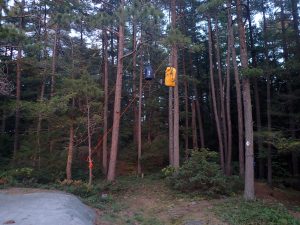
If I was still wondering if we had too much food I got my confirmation that night. Not only was it hard to get dinner and lunch down once again, but I broke a branch hanging the bear bag. Setting up the hang is always one of the first things I do when we get to a site so I can see what I’m doing before it gets dark. The night before on Carlyle Lake I’d found a nice branch at the right height. It groaned under the weight, but it held. This time I couldn’t find anything strong enough for our food but not strong enough for a bear, so I strung a rope between two trees and set up a pulley to haul the food bag up.
It was late by the time we were done eating and when I heaved on the rope to pull the bag up there was a loud crack and a branch came crashing down. It was too dark and too late to set up another complicated hang. We searched around for a while in the dark looking for another good candidate, but in the end I just hoisted the bag up into one of the two trees that still held the rope I’d strung earlier. The bag was hanging right against the trunk of the tree, and I’m sure a bear would have been very pleased to find such a convenient treat. I went to bed feeling a bit discouraged, and worried about what might happen to a delinquent bear that found our bag.
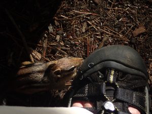
The next morning was the start of a beautiful, sunny, hot day. I retrieved our shoddily hung bear bag (unmolested thankfully) and made pancakes for breakfast. There was a particularly bold chipmunk at this campsite. Not only did he try to steal a pancake out of the frying pan he even jumped right onto my foot to eat some spilled batter off of my sandal.
Bold Thief
It was Alex’s birthday, and to celebrate we were going to tackle a brutal portage. The 2775m carry from David to Great Mountain Lake isn’t particularly steep, but it winds up and down repeatedly. There is a portion of the portage that’s navigable in good water, but I didn’t want to spend a bunch of time loading and unloading the canoe, so I decided to just carry from one end to the other. I was beginning to question my choice as I felt the burn of the yoke on my shoulders and I could see open water just a few meters away to my left. There were obvious put-in and take-out points every few hundred meters, but I hadn’t checked the status at the park office and didn’t want to paddle halfway only to get stuck and have to turn around.
The portage finally turned away from the water and removed the temptation, but that’s when it started to go uphill more seriously. After climbing a particularly steep hill the forest opened up and the trail turns and heads across a bare rock face. There’s a blaze to indicate the turn and then a series of rock cairns to guide you over the white quartz. Xander was behind me by this time, and he stopped to take a break when he got to the rock. When he got up he forgot about the blaze and headed straight into the woods. I was taking a break at the far end of the portage before heading back for my pack, and was wondering what was taking so long while he was lost in the woods. Fortunately he kept his head and when he realized his error he was able to retrace his steps and find the trail again.
My original plan was to take several breaks with the canoe, but I kept pushing on and finally decided to do it in one go. I was almost there when the canoe yanked back and stopped moving. I tugged again and it was stuck. I turned around and saw that the painter had come untied and had fouled on a few planks that bridged a muddy bit of trail. I backed up, rolled the canoe off of my aching shoulders and dropped to the ground exhausted. I drank half of my bottle of water and caught my breath before picking the canoe up and continuing on to the end.
This marsh is what we'er portaging around on the 2775m portage from David to Great Mountain Lake.
One of the potentially navigable stretches of water along the David – Great Mountain portage.
The rocky trail follows the side of the marsh.
Two years ago we camped on the island just ahead.
We passed a couple going the other way on the trail. There’s not much time for conversation when you both have canoes on your shoulders so we just exchanged pleasant greetings and moved on. These were the last people that we saw for the next two days.
As tough as the canoe had been to carry I actually found the second trip with the food bag harder. It was hotter by then, and the food was still heavier than the canoe, even if it was less awkward. Xander was getting way ahead of me on this trip, and when we got to the rock face I collapsed again to take a break. The rock was in the shade and surprisingly cool. I could feel the heat being drawn out of my body and into the rock.
We got out on the water quickly to enjoy a cool breeze on Great Mountain, and then started the leisurely paddle to Gail Lake. Gail is a close neighbour to Great Mountain, and only has a single campsite,, so by booking a site there we were guaranteeing ourselves the best site on the lake and also complete solitude. Finding the portage to Gail was a bit tricky because it’s on a featureless stretch of shoreline. After the long portage I was so hot that I broke down and checked the GPSr to make sure that we hadn’t passed it.
The portage to Gail is short, but steep. My feet sank deep into the mud at both ends. It’s a good thing that it was short, because I was overheating and out of energy by the time we got to our destination. The campsite on Gail features a huge expanse of white quartzite that stretches up the hill. Once the canoe was unloaded I stripped down and waded into the water for a swim to cool off and wash the sweat from my body. Even though I was boiling, the water was so cold that I didn’t go all the way in. Laying on the rocks and drying off in the hot sun was a relief after a short but exhausting day.
The campsite is very pretty, and features a suite of ‘Flintstone furniture’. Massive boulders with flat faces have been propped into position to form tables and chairs. I’m not a big fan of overdeveloped campsites where overzealous campers have built tables and benches, but I always use the facilities when they’re available. It does make for a nice break from squatting on the ground or a log while trying to do chores. The stone furniture fits in a little better than some of the clumsier wood constructions, and it’s kind of cute so I’m not sure how I feel about it.
Double Line Hang
We had some Ritter Sport bars for desert after dinner to celebrate Alex’s birthday and then I went to hang the bear bag. I’d strung a pulley between two trees again. It was a good hang, high off the ground and far from the neighbouring trees. The branches were both strong, so naturally this time the rope broke. I was so frustrated I didn’t even bother trying to ‘fix’ it, I just left the bag at the base of the tree. The next night I split the food into two bags and hung them both over the same rope. This worked much better, and after that I didn’t have any more problems with the weight of the bag.
We had a day off on Gail Lake. Originally I’d intended to do some ridge running and climb one of the nearby peaks, but we were both pretty exhausted after the last three days so we just lazed about at the campsite and other than a short walk and some camp chores we took it easy.
I’d had a hard time sleeping that night before. Initially I’d attributed my sore shoulders to a poor hammock hang, but a few days later I realized it was just the wear and tear of the portages. Once they toughened up I didn’t have any more discomfort at night. While I tossed and turned I could see lightning flashes illuminating the horizon in all directions, but there was no thunder. When I crawled out of my hammock in the morning the sky was an ominous grey and I could hear distant rumbling.
I retrieved the food bag and started some morning chores, but something told me that it might be a good idea to set up the tarp. I was just tightening some of the guy lines when I felt the first few spits of rain. The thunder got really loud and woke Xander. He joined me under the tarp as a huge storm drifted across the tiny lake and swept overhead. We could see the wall of rain slamming into the water before it reached us and then there was a roar as the tarp took the force of the water. We stayed dry under the tarp as we watched the storm roll past. Soon the rain stopped, and the thunder was no longer overhead, but we could hear it in the distance. Within an hour the sky was blue and it was another beautiful Killarney day.
Because it had been an easy day it was tough to eat our food ration, but the bag was getting noticeably lighter, which was a relief since we were nearing the toughest portages of the trip.
Leaving Gail was a long day, but not particularly hard. None of the portages were difficult, and we were in better shape and recharged after a day of rest. The day started out with a perfect blue sky and as we paddled across Gail we could see the shadow of our canoe gliding across the bottom of the lake.
Gail Lake
I was remembering getting my feet muddy when we arrived, but apparently I didn’t remember very well because we didn’t find the portage put in. I was standing in the trees with the canoe on my shoulders and I realized that I wasn’t on the trail. I had to bushwhack for a while before I finally found it and we could descend down to Great Mountain.
Muddy Sandals
The far end of Great Mountain is a flooded forest, full of dead trees and remnants of the logging camp that was once here. The water level was low so we had to pick our way carefully around half submerged logs, but we were finally in sight of the take out for the next portage with what looked like a clear path. But when we tried to move forward we bottomed out in the mud and couldn’t cajole the canoe into sliding any further forward. We were separated from shore by a 20 – 30m stretch of black ooze. I was contemplating getting out and walking through the muck to pull the canoe over when I glanced to my left and saw that another take out had been made in the tall grass. I still got my feet covered in muck, but after a couple of hops we found solid ground.
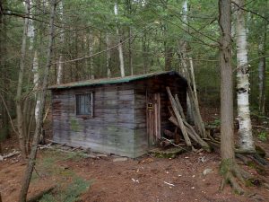
Trappers Cabin
The portage to Fish Lake isn’t particularly steep or long, and the slope it does have is downhill, but half way there I encountered a large tree blocking the path. I had to put the canoe down on top of one side, duck under the trunk, and then slide it over. It’s a pretty enough portage, and there’s an old trappers cabin at the far end on Fish Lake.
Fish Lake isn’t the prettiest lake in the park, particularly at the east end. We were most of the way across Fish when we spotted a canoe pulled up near a tent. It was the first signs of other people that we’d seen in two days. We didn’t actually see any people until that evening when we arrived at our campsite on Murray Lake.
The river meanders back and forth through this small valley between Fish and Gem Lakes. While scenery like this abounds in Algonquin, there aren't many places like this in Killarney.
Jeff’s map incorrectly labels this outcrop of Puddingstone as being between Howry and Murray Lakes, when in fact it is between Fish and Gem.
The west end of Fish is a bit more interesting and you can catch glimpses of the north LaCloche hills through openings in the shore line. There’s a short portage, and then a very convoluted stretch of Howry Creek snakes down a pretty valley. There’s a large puddingstone outcrop on the north side of the valley, and I took a few pictures of it to document its location. Last time we were here the creek was so dry that we had to get out and walk the canoe, but this time it was clear and an easy paddle to Gem Lake. Unfortunately by now the blue sky had turned grey so we couldn’t enjoy this pretty lake in all of its glory. Gem is ringed by tall rounded hills and feels like a tiny oasis. After Gem the portage to Howry is easy, and the east end of Howry is another very scenic spot.
Stone Chimney
We paddled to the end of Howry and got out of the canoe at the mouth of the next stretch of Howry Creek to explore where the map said the puddingstone should be. As I suspected there was no outcrop there, but we did find an old stone chimney, the only remnants of a long abandoned cabin.
This particular stretch of Howry Creek can cause problems in low water. It’s not so much the creek as Murray Lake itself, but by the time you get to the lake and discover that it’s not passable you’ve travelled a long way and have to backtrack back to Howry. There are several ways to detour through the low hills to the north, but they all involve multiple portages. I’d checked with park staff at the office before we headed out, but the breezy way that I was informed that it was passable hadn’t inspired confidence. After all, the staff at George Lake probably hadn’t been out here in quite a while! Fortunately the advice was good and the lake was navigable.
There’s a modest portage mid way down the creek and it was here that I realized that there may have been a problem with the canoe. I bought my canoe used from one of the Killarney outfitters. It was cheap, but it had a hard life before I acquired it, and it came complete with some extra wrinkles and dents in the kevlar skin. It’s still always proved sound, but when I picked it up for the portage it crackled suspiciously, and I could feel it flexing more than usual in my hands.
This is the far east end of Murray Lake, far from where the campsites are located.
Navigating the lift-over on Murray Lake.
There’s a lift-over not far after the portage, and as we slid the canoe over the beaver dam I could hear more crunching and creaking as it cantilevered. I made a mental catalog of all the lift-overs that we still had to do in the trip, hoping that the canoe would hold together. It made it through the trip, and never even leaked, but I’m pretty sure it’s shot.
I’ve never been to this end of Murray Lake, and it’s much bigger than I thought. I kept thinking that we were just around the corner from where the campsites are located, but there was always another bay to cross. Occasionally the lake would open up, but for the most part it was choked with lily pads and we had to pick our way through a narrow channel of deeper water.
When we finally got to our campsite we spotted the first people that we’d seen in days. They paddled past our site to go fishing in the weeds we’d just paddled through. The campsite on Murray wasn’t particularly nice. One of the problems with lakes that are easy to access is that some of the visitors aren’t as respectful of their surroundings as those who’ve had to make a signifiant effort to get there. While Murray isn’t exactly easy to get to, it is possible to visit it without any portages, and there was an objectionable amount of trash in the fire pit. On the other hand there was also some firewood and it was nice to be able to dry my feet out in front of the fire as we ate dinner.
I’d only planned one portage for the sixth day of our trip. The portage from Murray to Nellie Lake is known as “The Notch” and it’s one of the prettiest little slices of hell in the park. Starting from the crystal clear azure waters of Nellie Lake It winds down between two massive mounds of white quartzite to Murray Lake. There are several picture perfect meadows with spectacular views of the white hills. There’s a pristine stony creek that meanders back and forth across a gravel bed, joining several ponds that each display a unique landscape, and even two waterfalls.
It’s also the steepest portage in the park. The last time I was here I marvelled at the scenery as I descended down the steep trail. I also questioned the sanity of anyone portaging in the opposite direction, going uphill. Today Xander and I were going to be those people of questionable sanity. I must admit, I was a bit scared of this hike, which is one of the reasons that it was the only thing we had scheduled for the day. A short day would also give us a half day to enjoy Nellie Lake and recover from the ordeal. And once we’d made it to the top we’d have completed the hardest part of the trip. Sure there would be some long and difficult portages ahead of us, but It was literally all downhill from here.
There are two sections of the trail that are incredibly steep, separated by a relatively flat section. The steepest isn’t far from Murray, and the other is closer to Nellie. Even though it’s only 1420m long I decided to break the portage into three sections. For the first my goal was just to get to the top of the first steep section, and then take a ‘break’ by going back and getting the pack. When I got to the worst of the hill I paced myself, but the trail is like a ladder, and no matter how slow I went I had to lift myself quite high with each step. I was soon breathing hard and I could feel the burn in my muscles.
The mercy of this tough section is that it’s short. It didn’t seem short, but it was a relief when I was able to put the canoe down and head back for the second load. We met a father and his young son coming the other way, and it was fun to see them react to the nastiest portion at the end that we’d just climbed.
The second leg is almost completely flat, but there are a few streams to cross. There is a section where the trail forks and one branch climbs some rocks while the other meanders across a grassy meadow next to the creek. Naturally I missed the easy trail on the way in with the pack, but it’s easy to spot in the other direction so I took advantage of it for the return trip. The food bag was mercifully lighter by this point, which helped a lot.
I’d dumped the canoe at the base of the larger of the two waterfalls. It’s a very pretty spot if you step off the trail to the creek to take in the view. Which is a great thing to do instead of shouldering your pack or canoe and continuing on up the trail, but eventually there’s nothing for it but to push on. This section didn’t feel as steep as the initial hill to me, but Xander felt it was worse. It is rougher ground and requires a lot of attention to where you place your feet.
Technically Carmichael Lake, but they’re both the same lake.
Scrambling up the side of the hill looking back along the portage.
This section of stream that runs along the Notch is choked with dead trees.
Technically Carmichael Lake, but they’re the same lake.
When I finally caught up to Xander at the far end I was elated. We’d finished our toughest portage, it was still relatively early in the day, and we weren’t completely exhausted. To celebrate we left our gear and headed back down the portage a bit to where a side trail climbs the mountain on the west side of the trail. We climbed up to get a better view of this spectacular spot. I was reluctant to go very far because I was aware of our unattended food bag tempting critters at the shore of the lake, so we didn’t go all the way to the top, but it’s a very rewarding scramble with some great views. We took a different path back down and made a very unexpected discovery – someone had left two swimming flippers on the ground halfway up the mountain. We weren’t really equipped to take them out, but we did carry them down to the end of the portage in the hopes that someone on a shorter trip could get rid of them.
This pest was on the pack waiting for us to open it up before we’d even set up our gear.
I hung my hammock right next to the water.
We chose the first campsite on Nellie Lake. Being between the three portages it gets more traffic, but it’s a very pretty spot. In order to get an early start we’d had lunch for breakfast, so after setting up camp I made some chocolate bannock for the breakfast we skipped. There was a very bold chipmunk at this campsite, and when we refused to give him a treat or let him try the bannock batter he perched nearby and chirped incessantly at us. He got his revenge a bit later; when the frying pan cooled off enough he managed to grab a piece of bannock and drag it onto the ground.
It was so hot that I went for another swim. Not only was this a good excuse to wash the sweat off of my body, it was fun to play in the oddly clear waters of Nellie Lake. I tried some underwater photography and explored the water near our campsite. The last time I tried to swim in Nellie Lake it was cold and windy, which made it uncomfortable to get all the way in the water, so this was a real treat.
The view underwater at Nellie Lake.
One of the many dead stumps under the pristine waters of Nellie Lake.
We took it easy for the rest of the day. We were sitting around the fire and I was trying to take some time lapse photos of the stars when we started to comment on the bright lights on the horizon. We’d been seeing bright lights on all of the clear nights and were debating on whether they originated from Sudbury or Espanola. We had been slightly disappointed that the sky wasn’t darker this far into the park. But these lights couldn’t be the glow from a city because they stretched from the horizon and went straight up.
Northern Lights
We were trying to figure out if they were indeed the aurora borealis or not when they obliged us by moving. At first the movement was slow, but it was evident that there was no point source over the horizon. Just when we’d decided that the lights were going to give us a nice, but quiet show they started to move more quickly. The thin beams spread out into great sheets, and then the whole sky started to flash. Eventually we could see large beams directly above us shining down. To my eye the lights were always white, but in my pictures they turned out green.
We crawled into our sleeping bags after a great show in the sky, and for some reason I got phobic hanging there next to the lake. I kept hearing small animals running around and my imagination kept running away with me. I knew it couldn’t be a bear, but I couldn’t figure out what would be running around so much in our campsite at that time of night. I read my book for a while and eventually drifted off into a fitful sleep.
The portage in to Nellie may have been the hardest of the trip, but the portage out was a contender for second. The saving grace of the trail to Helen Lake is that at least it’s downhill. Almost two and half kilometres of downhill, but it does go down. We took our time and had a good breakfast before heading out.
We started out the day with a mistake – I mistook a boat stashed near the end of the portage for the start of the trail. We’d unloaded our gear and I had the canoe on my shoulders before I realized that the trail I thought I was following was just random gaps through the trees. I turned around a few times before putting the canoe down so I could search properly. I finally found the trail, and it was a bit embarrassing to have missed it since it was so obvious. Then it was back for the canoe and the long walk had begun.
Faux Lake is gone! The rocks ahead are normally an island.
The beaver dam that held Faux Lake in place is completely open.
The scenic rock shelf that separates Helen Lake from Low Lake houses a campsite.
This is a pretty trail, but nothing like The Notch. There’s a small lake half way along the portage that can usually be paddled to shave a few hundred meters off. The last time we were here we did exactly that. It’s simply labelled Unnamed Lake, or Faux Lake on some maps. But it requires a short detour, and if water levels are low it’s not passable. I didn’t want to risk going down to the lake and then coming back if it wasn’t passable so I decided to do it all in one go. I was starting to regret this decision as the trail climbed over some rocks after passing the take out for the short cut, but when the lake became visible below I was shocked to see that the water was gone! The trail crosses a beaver dam that used to hold the lake in place, but there’s a gaping hole in the dam now, and what used to be a marshy pond is now a grassy field.
My shoulders were screaming by the time I got to Helen Lake, and I took a break while I waited for Xander. The return trip was longer than I remembered, and I kept thinking that we were almost there. The food pack was now significantly lighter than the canoe, which was a relief after such a long walk.
Helen is a pretty lake, and if you look back you can see the North LaCloche hills poking above the trees. It was a bit surreal to realize that we’d been camped on a lake perched high up in those hills just a few hours before. The portage from Helen to Low is a shelf of white quartz that doubles as a campsite. It’s not particularly long, but it’s pretty steep. Both Low Lake and the portage are quite pretty.
Rocky Channel
There are a lot of submerged logs at the far end of Low Lake, and I was worried that these might damage our canoe further. Last time we managed to get through this section by doing a few quick lift-overs, but this time I didn’t want to risk it. Fortunately there was an extra portage around this section and we were able to avoid any mishaps.
After Low Lake there’s a marshy pond that’s so covered in lily pads and bullrushes that navigation is a challenge. We wound our way through this confusing but pretty place and then we just had a short portage down to McGregor Bay.
At this point we were technically on Lake Huron, so there were no more portages for a while. McGregor Bay is very scenic, and has a unique feel of its own. Nestled between the north and south forks of the white quartzite LaCloche Hills, McGregor Bay is dotted with small islands of pink granite. Unfortunately with the open water comes boats and cottages. The last time we were here it felt like a traffic jam – there were boats everywhere. We were luckier this trip, and didn’t see any boats at all on our first day.
The cottages are always there however. We were paddling past a large cottage under construction and I was thinking to myself how it broke the spell of being in the wilderness when all of a sudden a powerful stereo was cranked up and the previously quiet air was filled with the sounds of classic rock. My annoyance increased with this new intrusion, but then the owner of the monstrosity ran down his expansive dock and literally greeted us with open arms. He invited us in for a beer if we wanted, or to spend the night. We declined politely, but it was hard to stay annoyed with the guy when he was so friendly. And while his cottage didn’t fit with the experience we were trying to have, it was a nice cottage and seemed to suit him fine. At least it’s outside of the park in a mixed use area.
After passing the cottages we paddled through the Russian Pass. The pass is a small channel blasted between the mainland and McGregor Island. It was allegedly constructed by a logging company in the early 1900s. When water levels are low the pass can require a short portage, but there was plenty of wet today and we paddled through without problem.
We could have camped for free on the abundant crown land in the bay, but just to be safe I’d booked one of the sites in the park. The last time we were here the site on the nearby point was the nicest looking one, so we stayed there. It’s a very scenic site with great sunset views, but if there’s a lot of boat traffic it’s not very private. Jeff’s map warns that the sites in the East Channel are messy and infested with cockroaches. It was a bit messy, but not nearly as bad as our site on Murray had been, and we didn’t find the cockroaches until the morning when some of them scurried away after I lifted the lid of the thunder box. Finding the thunder box was a bit of a chore, because the site’s so open and public the facilities are located quite a ways back in the woods. It’s also a challenging site to set up a hammock. There aren’t many suitable trees, and I had to pitch my hang way up the hill. Not only was it a bit of a climb to get to, the terrain underneath was pretty treacherous.
It was a really hot sunny day when we got to our site, and we had an ample supply of firewood so we made a nice fire almost as soon as the sun set. I was quite surprised when I stepped away from the fire after dark because it had become really cold. Our packs were covered in dew because of the sudden temperature change and I scurried back to the sanctuary of the fire. The cold was a bit of a relief because it chased off the mosquitoes. Until that night we’d seen about one or two of the flying parasites per day, but that evening there was a small swarm of them. Not what you’d experience in the spring, but enough to be annoying while we ate dinner. There were also a few mosquitoes the next night in Baie Fine, but once we returned to the interior of the park the bugs were gone.
I was a bit worried that I’d be cold sleeping in the hammock, but my gear kept me warm. What I hadn’t anticipated was another night creature that woke me while sniffing around underneath me in the middle of the night. I’d left my sandals on the ground, and I had visions of them being chewed up by some misguided animal, so I finally got out and hung them over my ridgeline.
After a cold night we had a cool morning, but it was bright and sunny, with not a cloud in the sky. It made for an excellent backdrop to paddle through the scenic rocks of the bay. We were lucky again and there were relatively few power boats out and about that morning. Rather than heading directly for the portage we stopped to find a geocache on the south LaCloche ridge. I’ve been wanting to find this cache for years, but never had the opportunity while in the area. The cache is at the peak of the ridge between McGregor Bay and Baie Fine, but there’s a well marked trail that leads to the top.
Misty morning on the East Channel of McGregor Bay.
Since we’d be away from our canoe for a while we hung our food at the base of the trail before heading up. We’d been doing some long portages, and by now they were starting to feel easier. When we started the trip each trail left our muscles burning, and while it wasn’t easy yet, we felt a lot more confident. Perhaps that’s why we were a bit cocky about climbing the hill. After all, we weren’t going to be carrying our packs or the canoe, so it seemed easy. We started moving up the trail pretty quickly, but we were soon heating up and running out of breath. By the time we stopped to catch our breath I was feeling the burn in the large muscles of my legs.
The pain is definitely worth it though. At each turn of the trail we were rewarded with a better view of McGregor Bay far below us. Hundreds of islands forged by glaciers from pink granite dot the sparkling water far below. Even the trail itself is spectacular. It winds back and forth up the mountain across exposed rock faces and through tiny chasms and between huge quartzite boulders. It’s relatively well marked, but at times it can be moderately challenging to follow. Once you get to the top not only can you see McGregor Bay, you can look across the other side of the hill and look down on Baie Fine. Even if you aren’t a geocacher this excursion is definitely recommended.
The sign says that the peak is the next hill over. The actual peak is to the left according to my map.
After returning to our canoe we headed west down the bay rather than turning east back into the park. Returning to the park immediately involves a very scenic paddle down Kirk Creek, followed by a brutal portage from Three Narrows Lake to Artist Lake. Affectionately known as “The Pig” this is one of the toughest portages in the park. We’d already done three of the worst portages on this trip so we opted to cross the ridge to the west instead. At almost one kilometre this isn’t a trivial portage, but it is almost completely flat which is much easier.
The portage leads to Baie Fine, one of the largest freshwater fjords in the world. We’d seen Baie Fine earlier in the day when we hiked to the top of the ridge. We’ve visited most of the ridges in Killarney, and while I was expecting great scenery I wasn’t really thinking it would seem different than other places we’ve visited. Killarney’s ability to surprise is seemingly endless, and I was blown away yet again by the unique geography in this area. I kept turning around to see the sun sinking low over the tall hills flanking either side of the long wide channel behind us.
Baie Fine was the largest water that we paddled on the trip, and was considerably rougher. It was still relatively easy because there wasn’t much of a wind. And while we occasionally passed motor boats and large sailboats there was enough room that they didn’t disturb us.
After the fjord we ducked back into the park and into a narrow channel that leads towards “The Pool” which is a popular anchorage amongst the boating crew. We took the first campsite in the small channel to avoid the crowding further upstream. There’s another campsite directly across the channel, and it was occupied, so these were our closest neighbours of the trip. The site isn’t spectacular, but it has a great view of the sunset and the sunrise up and down the channel, and was amply provided with firewood.
As much as the scenery in McGregor Bay and Baie Fine is spectacular I was looking forward to returning to the interior of the park where we wouldn’t see any motor boats and there would be far fewer people. The return to the park was to be our last hard day of the trip, but with only two moderate portages and a nearly empty food pack it wasn’t very daunting.
Xander dries his tent on the rocks before we head out.
We had another beautiful sunny day to enjoy the scenery as we paddled down to our first portage. We passed a couple of sailboats that had been anchored for the night, and as we passed one of the cottages in “The Pool” we were offered a cup of coffee.
The portage to Artist Lake is relatively flat, but it can get a bit tricky since four different trails intersect in the middle. The Silhouette trail crosses the portage, and continues over the ridge as the infamous “Pig” portage. Making a wrong turn here in either direction will set you up for an unnecessary world of pain. We actually did go the wrong way, but we did so on purpose. Between our two trips across the portage we stopped at the halfway point and climbed part way up the hill to Topaz Lake.
Topaz Lake is a crater lake nestled high up the ridge. Sporting rich azure water ringed by white quartzite cliffs it’s another classic example of Killarney’s scenery. The last time we visited Topaz we were so exhausted that we only paused for a few minutes at the top of the cliff to look down on the water below. We had more time and energy this time so we descended right to the water and spent some time enjoying the spot. We didn’t have it to ourselves however. A group of cottagers had boated over to the end of the portage and then made the short hike up to the lake. We chatted with them briefly, before heading back down to get the rest of our gear.
The infamous 'Pig' portage. Not only is it tall, the trail is littered with boulders.
As we returned down “The Pig” I was surprised that it was much nicer looking than I’d remembered. Perhaps my past perception was coloured by the pain of having to carry a heavy load over this brutal trail, but I remember thinking that it wasn’t a very nice spot at the time. Pretty or not, it is a brutal trail. Not only is it the tallest portage in the park, the path is littered with huge boulders that make finding good footing a challenge.
Ironically, I twisted my ankle on this trip on the relatively easy terrain on the way to Artist Lake. I rolled to prevent an injury, but I almost dropped the canoe. I don’t know how I managed to catch it, and while I didn’t hurt myself seriously I was limping for a while and was worried that I might not be able to finish the trip. Fortunately, I recovered quickly after favouring the leg for half an hour.
Artist Lake is more of a marsh than a lake, choked with lily pads and dead trees. It’s also quite scenic, particularly to the west. I kept turning around to take in the white hills that frame the end of the lake. There are two small ponds that separate Artist and Muriel Lakes, and in the past both of them were navigable, but we had to carry around the length of both of them.
Muriel is another pretty lake, but it pales a bit in comparison to its neighbours. We met a large group of people sorting through their gear at the end of the portage to O.S.A. Lake. We were pretty organized by this point and cleared out of there pretty quickly while they dealt with all of their packs and bags. Other than having a slight climb the portage to O.S.A. Lake isn’t particularly difficult.
The portage to O.S.A. Lake from Muriel Lake.
The view of our campsite after I swam out to the nearby rocks.
O.S.A. Lake was the first lake in the park, and is arguably one of the most scenic, and hence, popular. I had lost track of which day it was and for some reason I thought that the long weekend was over and we’d have an easy time finding a site, but it turns out that it was Labour Day. We did a small tour of the lake checking out various sites, but they were all occupied except for one that I’d used previously. It’s a nice site, but not as nice as some of the island sites in the middle of the lake. Since my last visit a large tree had been cut down and someone had built a full counter and kitchen area with the cuttings.
We managed to reach our site fairly early in the day, and it was a beautiful day so I took the opportunity for another cleansing swim. The swimming at our site wasn’t the best, but it served to wash the grime and sweat of the last few days off. I swam out to a nearby island and then dried out in the sun on the rocks.