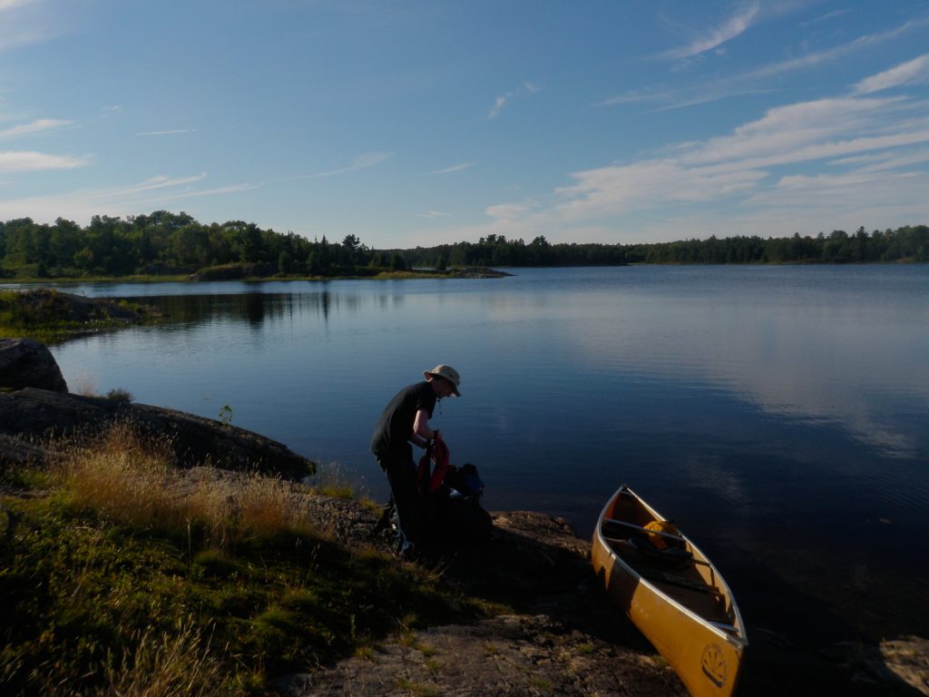
When I booked my trip to Killarney this year I had no idea that I’d be knee deep in preparing my home for sale by the time it was scheduled to start. I made the reservations in late March, and by the time August rolled around my life was in turmoil. I almost cancelled the trip because I simply didn’t have time to do everything needed to get ready for spending eight days in the wilderness. After a summer of home renovations I was really ready for a break though, so I decided to go for it. I quickly gathered food and gear while making the last minute preparations in three days.
Despite the mad rush we ended up with almost exactly enough food, and with the exception of fresh batteries and some rain gear our equipment was adequate, but not overly heavy. We took three packs for two people, and ended up with two 25 pound packs, and a third 35 pound pack that contained the 24 pounds of food we’d need. This proved ideal and really made the portages easier. Early in the trip we could do double carries, and then as the food bag got lighter and the portages longer we could double up the load and make a single trip to save time.
Even though this was the longest and toughest trip that I’ve done, and I felt out of shape after a summer indoors, it ended up being relatively easy thanks to the lighter loads.
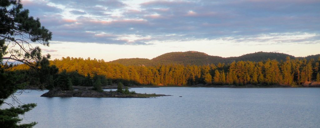
After spending the night in Sudbury we headed to Espanola after breakfast. It was after 11 by the time we had our permit and were on the water, and we had to start with the long paddle down Charlton Lake to Murray Creek. I had considered using a water taxi to shorten the trip through motor boat infested waters outside the park, but we had enough time and paddling the whole way gave me the opportunity to grab a geocache I’d missed the year before. We had to fight a stiff breeze on Charlton Lake, and this gave us an opportunity to warm up gradually to the exertions of the trip
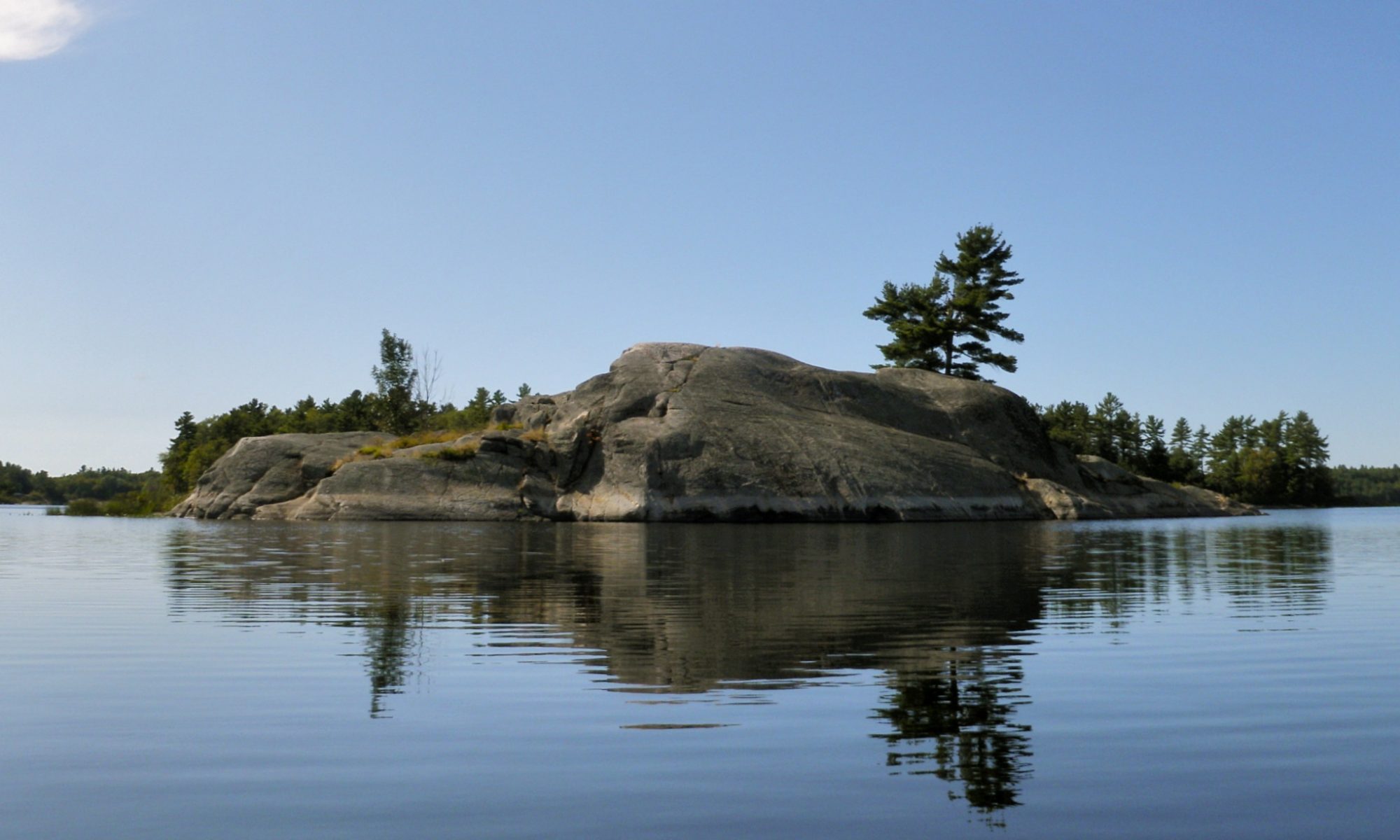
After Charlton Lake comes Howry Creek which winds it’s way along the north end of the park. This is a very easy portion of the trip with no wind and only a few beaver dams to lift over before getting to Murray Lake. The flat terrain that makes for such easy travel comes at a price however. Part of what makes Killarney such a spectacular place to visit are the white quartzite slopes of the LaCloche Hills and they only serve as a backdrop for this portion of the trip.
The beavers are constantly adjusting the locations of these liftovers, but we found this one right where I left it last year.
Howry creek widens into this marsh.
Looking west as we enter Murray Lake.
Murray Lake is pretty, but marshy. Its dominant feature is the imposing Notch Portage through the mountains and up to Nellie Lake. The Notch is a very scenic portage carved into a cleft between two mounds of quartzite. It’s also the steepest portage in the park and a brutal carry when travelling south, so our route was to take the much easier portage north from Murray to Leech Lake.
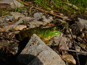
Frog
The portage is about a kilometre long, and is relatively flat and easy. We were still loaded heavily enough that we did a double carry, and we also watched our feet carefully at the south end of the portage where the guide books warn there’s an infestation of poison ivy.
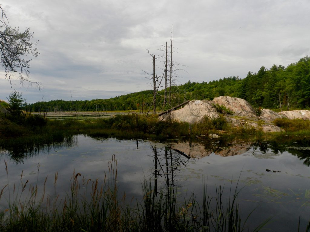
Leech Lake is in the process of being added to the park and it has even less scenic charm than other border lakes such as Murray or Howry. Leech was the site of several mining claims, and while we didn’t see any evidence of mining it has a desolate blasted appearance and in many places the shore of the lake is lined with rubble.
Leech Lake
The sun was getting low in the sky by now so we proceeded directly to the short portage to Hanwood Lake where we were to spend the night. Hanwood is prettier than Leech Lake, but there’s still a lot of rubble on the shores and the woods have a scrubby appearance that’s more reminiscent of Muskoka than Killarney. The owner of Widgawa Lodge who sold us our permit suggested that we camp on the island campsite on Hanwood Lake and it did look much nicer than the other site high up on the shore. The one downside to this site is that it has no thunder box, so cat holes were required.
It hadn’t been a particularly hard day, but it was long. I’d managed to keep my feet pretty dry despite all of the lift overs, but when I went to get water I fell into the lake! The slope was quite steep, and I carefully steadied myself on the rocks, but when I sat down I slipped and ended up soaked to my knees. If anything it was refreshing after such a hot day. The night was warm as well and I barely used my sleeping bag.
We changed our travel plans on our second day. Originally we were going to visit some of the northern lakes before heading south to Fish Lake, but we were advised water levels had made travel through Goose Lake difficult so we decided to head south sooner and then east along Howry Lake. Our ultimate destination for the day was Great Mountain Lake, and we could have proceeded directly east from Murray Lake to Howry the day before, but the east end of Murray can become impassable in low water. Since I booked the trip in the spring before water levels in late summer were known I had decided to play it safe and book our first night on Hanwood Lake.
Hanwood Lake early in the morning.
This little guy was quite content to leave our food alone and satisfy himself with pine cones for breakfast.
In the future I’d be tempted to plan the trip without booking any sites on the lakes to the north. Not only does it save a few portages, the northern lakes aren’t nearly as scenic as those closer to the LaCloche Mountains. By booking the first night on Murray Lake it would be possible to decide which route to take once the water levels are known. Another option would be to book the first night on Howry Lake and use a water taxi the first day to ensure that there was enough time to detour north around the end of Murray Lake if necessary.
The portage from Hanwood to Van Winkle Lake is very short but also very steep. Van Winkle is a pretty lake, but like all of the northern lakes there are motorboats stashed at the ends of the portages for anglers from nearby lodges. The lodge owners rent motors to their guests and they carry them from one lake to another, changing boats as they go. While the boats are quiet and we only saw a few in operation their presence does shatter the illusion of being in the backcountry. Despite the fact that Killarney is classified a wilderness park, only a handful of the lakes that we visited were completely free from motorboats.
We met some of these sportsmen on Cat Lake after completing the portage. They were draining their plastic fishing boats before stashing them in the bushes and returning to their lodge. They were quite friendly but couldn’t understand why anyone would want to paddle when they could use a motor, and didn’t see the point of being on the water without a fishing rod. Cat Lake isn’t the prettiest of the northern lakes but it does have a rather spectacular view of the LaCloche Hills to the south.
This old cabin was apparently erected to exploit a mining claim before being owned by a hunt club, and now serves as a ranger station.
This Cabin
Built In The Early 1930’s
And Turned Over To
Killarney Provincial Park
in 1990
To Be Used As A Ranger Station
Thanks To The
Cat Lake Hunt Club
We saw several of these snakes. While their markings are similar to a Massassauga Rattler, I believe that it’s an Eastern Watersnake. We caught this one digesting his breakfast.
We decided to explore a small cabin on the shore of Cat Lake before continuing. The cabin was built by Hugh Teck Gold Mines and later become the property of the Cat Lake Sportsman Club. It’s a rather functional, unattractive building. We hunted around for a while in case there were ruins from an older structure or signs of prospecting but we didn’t find anything. The cabin has now been donated to the park and serves as a ranger station.
The portage from Cat to Howry Lake is a bit longer, but not bad overall. Howry Lake is more scenic than the lakes further north,and is less marshy than Murray Lake to the west. We paddled to the west end of Howry to see if we could spot the outcrop of puddingstone that was marked on Jeff’s Map before heading east. We didn’t find the outcrop, but then again we didn’t leave the canoe. Later in the day we did spot a puddingstone outcrop between Gem and Fish Lakes, so perhaps there’s an error in the map.
Howry is a nice lake and while there is a cottage on it we didn’t see any activity. It’s long enough that it takes a while to paddle before reaching the pretty portage at the east end where Gem Lake spills out through a series of scenic cascades. This is a very easy portage, and the smooth rocks and scenery make it a nice spot to stop for a swim or a snack.
Howry Lake from the takeout for the portage to Gem Lake.
We saw many paints on this trip, but no snappers.
Howry Creek winds it’s way back and forth down this valley between Gem and Fish Lakes.
There’s an outcrop of puddingstone marked on Jeff’s map on Howry Lake, but I believe that it’s actually here on Howry Creek between Gem and Fish Lakes.
When the water got too shallow we had to get out and walk the creek.
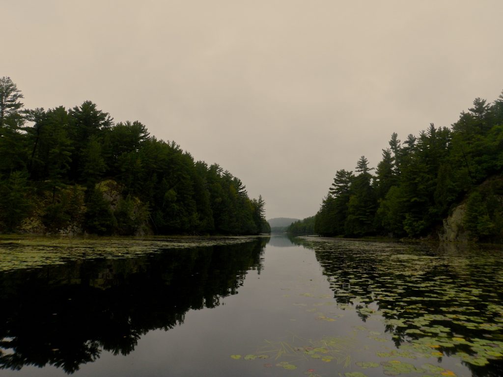
Gem Lake is aptly named. The small lake is surrounded by low hills except where a gap reveals the much more impressive LaCloche mountains to the south. The route continues to the north through a valley where a meandering creek winds it’s way back and forth between tall grass on the way to Fish Lake. Paddling the valley is quite slow since the creek twists and turns so much, but it’s a nice place to do so. We saw the large puddingstone outcrop on the north wall of this valley, and the granite slopes on either side frame the creek nicely.
Travel was slow, but easy, until we reached the west end of the creek and the water got more shallow. Eventually we had to get out of the canoe and wade as we lined the boat across the sandbars for the last few meters before the portage.
The portage to Fish Lake opens into a pretty bay, but I found the rest of the lake a bit dull. There was an incident that made this section more memorable however. As we rounded a rocky point Alex pointed and exclaimed “A Bear!”. Sure enough, about 50 meters away a large black figure was studiously disassembling a beaver lodge on shore. He was pretty ropy looking, and so intent upon his task that he didn’t notice us at first. He must have heard me put my paddle down as I pulled out my camera because he looked up suddenly with a guilty expression on his face before turning and bounding up the hill. The lodge was at the bottom of a steep rock face, but the bear ran up that hill much faster than I would have imagined possible. I was astounded by his speed on such rough terrain. He was definitely a “good bear” with the correct reaction to humans, but I’m sure glad I didn’t have to try to outrun him.
There’s an old trapper cabin on Fish Lake at the start of the portage to Great Mountain Lake. It’s older and more rustic looking than the rather ugly cabin we had explored earlier in the day and it seems more at home in wilderness. This was another uneventful portage over easy terrain before we found ourselves in a small marshy bay of Great Mountain Lake. The bay is choked with old stumps and vegetation and provides a rather unimpressive introduction to this remote lake.
It was late in the day and there was a bit of wind so we paddled almost directly to our campsite on an island in the eastern bay of the lake.
I don’t know anything about this old Trapper Cabin. We saw a few more like it.
Looking west on Fish Lake from the portage to Great Mountain Lake.
Our third day was to be a break day to enjoy Great Mountain Lake, so I planned to do some ridge running to get a view of the area around us. From our campsite on the island in the east bay Great Mountain Lake wasn’t that impressive. While it is pretty I had hoped for a lake ringed by tall quartzite mountains. We found them when we went paddling to do our ridge running.
At the southern end of the lake is an impressive cliff next to the portage that leads to Little Mountain Lake. Unfortunately, the best campsite on the lake which has a spectacular view of this cliff also happens to have a private cabin on it. The cabin was precisely why I avoided the south end of the lake when choosing a campsite. There’s an official campsite closer to the cliff that I’d choose in the future, or I’d take the advice of the guidebooks and reserve the single campsite on Gail Lake which is a short portage away from Great Mountain.
Best Campsite
I was hoping to summit some of the peaks on the south side of the ridge that flank the Silhouette trail, so we beached our canoe on the shore of the lake and started bushwhacking uphill. Ridge running in Killarney is moderately easy except for the navigation challenges. The bush is thin enough that no trail is needed, and when you reach the exposed quartzite the views can be spectacular.
We did summit the smaller local peak that looks down upon Little Mountain Lake. We could see all the way to the south LaCloche range, and in some locations we could see both Great Mountain and Little Mountain Lakes. Little Mountain is everything that I’d hoped Great Mountain would be. The water shines with the unique shade of blue that Killarney lakes are famous for, and the tiny lake is surrounded by towering white peaks. Unfortunately the only campsite on Little Mountain is reserved for hikers so we couldn’t stay there.
We enjoyed the view for a while before pressing on to greater heights. This is where poor planning bit me. The terrain kept rolling up and down, and even though we were only a few hundred meters from our destination it was getting late and we were low on water so we decided to turn back. If I were to attempt this climb again I’d paddle across Little Mountain Lake and then follow the Silhouette Trail to the base of the mountain to reduce the amount of bushwhacking.
Talls cliffs in the ridge that separates Great Mountain Lake from Little Mountain Lake.
Great Mountain Lake on the left and Little Mountain Lake on the right.
Little Mountain Lake has the distinctive clear blue water for which Killarney Lakes are famous.
As we descended back to our canoe my GPSr suffered a glitch and erased all of the track data from the trip so far. Up to this point all of the track points are synthesized from my satellite beacon or interpolated from my pictures. Not only was it frustrating to loose the record of our trip so far, it also made it a bit more difficult to find the best way down off the mountain to where our canoe was parked!
A small weasel or otter popped out of the bushes to watch us as we got ready to board the canoe and fight the winds back to our campsite. It watched us for a while before darting off very quickly in the other direction. Unfortunately I didn’t manage to get a picture of the creature.
Once back at our site we had a leisurely evening and I took advantage of the opportunity to wash some of the sweat out of my clothes.
The guidebooks advised that the trip from Great Mountain Lake to Threenarrows Lake could take all day so we tried to get an early start by eating GORP for breakfast and breaking camp as soon as we got up. It was still 9:40 before we were on the water, but that’s an early start for us!
The portage to Little Mountain Lake is very short, but also has very rocky put ins and take outs. We met a couple doing the portage in the opposite direction and I had to negotiate for passage with the woman since we both had canoes on our heads.
By the time we travelled on Little Mountain Lake it was cloudy so we couldn’t appreciate the crystal clear water up close.
The sky had turned cloudy so we weren’t able to truly appreciate the clarity of the water on this pretty little lake up close. The water in Little Mountain Lake is reportedly almost as clear as Nellie Lake, and the dramatic surroundings would make this a spectacular spot on a sunny day.
After the Lake we had two 1Km portages interrupted by a relatively easy crossing over the north fork of Kirk Creek. I was still doing a double carry, one trip for the canoe and a second for my pack, but Alex chose to carry both of his packs at once to reduce the number of trips needed.
The first portage is a nice little path and crosses over the northern section of the Silhouette Trail just south of Little Mountain Lake. The path rises very briefly and then descends gradually. The second portage has a little more up and down, but neither is particularly difficult. The first crossing of Kirk’s creek is a wide boggy valley populated by dead trees and framed at either end by views of the LaCloche Mountains. Despite the size it’s apparently not navigable so the route crosses the creek directly before proceeding to the second portage.
It started to drizzle as we crossed the creek, but I put on my kevlar hat for my first run across the portage, and the rain had stopped by the time I made my return trip. I met Alex on my return trip. Even though he’d done a single carry by taking both packs the bugs at the far end were bad enough to drive him back along the trail.
Before joining the south fork of Kirk Creek the journey between Little Mountain Lake and Threenarrows Lake crosses the north fork of the creek. The south LaCloche Hills are just visible in the background.
Looking back after the short creek crossing. The put in on the far side was really muddy.
The south fork of Kirk Creek isn’t nearly as scenic as the north fork. Despite being so nondescript it’s quite deep.
Alex waits for me to turn around the canoe and pick him up after a short liftover.
The remains of an old logging dam on Kirk Creek are visible on the left. The creek would be damed in the spring to flush logs down the channel when the water was released.
The second encounter with the creek is visually unremarkable. The trees part to reveal a small patch of grass that opens onto an unimpressive looking trickle of water that winds its way off in both directions. Appearances can be deceiving however and this section is quite deep, so unlike the north fork it is navigable.
My first instinct was to follow the creek left, but after carefully consulting the map, GPSr and guidebook I realized we had to go right. There are several more twists and turns on the creek where careful consultation of the navigational materials is needed and we did have to back track once when the GPSr indicated we’d chosen the wrong fork. This is definitely an area that tests your navigation skills.
There were several small lift overs on the creek, and after a while the scenery did get more interesting than a sea of grass on either side. Occasionally the creek follows the base of a rock face, or the trees part enough to reveal more impressive hills in the distance. Some of the portages bypass small swifts or waterfalls, and the remains of an old logging dam can be observed at one location. But on the whole this portion of the trip has less dramatic scenery than those in the mountains or out on McGregor Bay.
We only met one other group of canoeists on the creek, near the end. One of their number had just been stung by wasps and was warning us of the nest on the final short portage to Threenarrows Lake, but we didn’t see any. We did startle a deer on our way back on the portage for our second load. When the deer heard us it let out a piercing shriek which made us jump before it leapt off the trail and into the woods. I rarely see deer when in the backcountry, but we saw two deer that day, the second one was watching us from a clearing as we paddled by on Threenarrows Lake.
I have a complicated relationship with Threenarrows Lake. It’s a man-made lake, formed by an artificial dam that joined three natural lakes into one sprawling spidery maze. One of my personal challenges in life is to paddle this beautiful lake without complaining incessantly about the few cottages that dot its shore and the motorboats they bring. They really feel out of place right in the centre of a wilderness park, and I have to control my annoyance and just appreciate my surroundings.
I’m also addicted to quartzite. The hard white LaCloche mountains are so unique that it seems a bit of a shame that Threenarrows which is at the centre of the park has none of the white rock the area is famous for. I was disappointed by the lake on my first visit and I was determined to give the lake another chance on this trip. After our return visit I have to admit that Threenarrows is a beautiful lake. The LaCloche Hills are visible to the north and south, and while the granite ridges that line the many channels and bays of the lake are less dramatic they have their own rugged beauty and serve as more than just a foreground for the more spectacular hills in the distance.
Roadster
Before heading out we searched for an old 1920’s roadster that’s been converted for off-road use that was marked on Jeff’s Map. The roadster is a unique remnant left over from another era in the park’s history. I’m a bit torn by artifacts like this. As much as I’d like to see the park preserved in a truly wild state, and I don’t believe that cottages or motorboats belong, I do find older relics such as this or the old logging Alligators in Algonquin park interesting to visit.
Paddling Threenarrows can take quite some time because of the way it snakes back and forth. I find that the east end of the lake where we entered is more scenic than the west (as well as having fewer cottages), but we also had a big day on Thursday so I wanted to cover as much ground as possible before making camp. We saw several campers at the east end of the lake, but there were also some really nice sites available. We passed site 45 and debated stopping for the night. It’s at the intersection of the prettier section of the Lake to the east and the more open area to the west that has great views of the distant hills.
There was still some time before dusk so we decided to press on and try for site 52 at the north end of the lake. I was just starting to reconcile myself to Threenarrows Lake, but as we approached site 52 we realized that the cottage nearby was running a loud generator (another questionable activity in a wilderness park). The sound didn’t stop as we got closer so we decided to skip that site and continue to the site on Doris Island, but that site was occupied by canoeists when we got there.
Sunset On Threenarrows
There were only three more sites on the west end of the lake and I was beginning to worry that we’d have to paddle all the way back to the east end. It didn’t leave me in a good frame of mind to appreciate the setting sun, but even the western end of the lake is prettier than I remembered.
When we first spotted site 46 it didn’t look that nice. The shore is steep and covered in broken rubble, but it wasn’t taken and I was so relieved that I didn’t care. Once we beached the canoe and climbed the slope we were rewarded by great views of the hills to the south in two directions. There was an ample supply of fresh split dry wood for the fire, and an easy spot to hang the bear bag. This definitely isn’t the site to choose if you want to go swimming, but it’s a great place to enjoy a spectacular sunrise or sunset.
Any remaining reservations I had about our campsite were dispelled when I woke the next morning. The sky was clear and a thick mist was rising off the water. The slanting rays of the early sun cast a golden glow on the mist as it climbed into the tall hills visible in both directions from our campsite. It was a spectacular morning. Even the wildlife participated in the show. Two huge pileated woodpeckers flew right into our site and flitted from tree to tree. When I went down to the water small minnows swam right up to my hand, and a chipmunk stole a bag of GORP while we ate breakfast.
Because the meal planning was a bit rushed we ate a lot of pancakes on this trip.
Looking southwest from our campsite.
It was hard to leave such a nice spot on a beautiful morning, but we had a big day ahead of us. Even though we wouldn’t have much distance to portage we would have to do a lot of paddling to leave Threenarrows and then find a good campsite on McGregor Bay.
The dam that contains Threenarrows Lake is at the southwest corner where it empties into the bay via the continuation of Kirk Creek. We met some hikers at the dam, a father and his teenage daughter. They’d lost the Silhouette Trail and couldn’t locate their campsite because they took a shortcut and their map was out of date. We were able to set them straight before we explored the dam and continued down the creek.
This section of Kirk Creek is much more scenic than the one we followed the day before into Threenarrows Lake. It’s much rockier, and the scenery gradually transforms from the grey granite found on Threenarrows Lake to the pink reddish rocks found on the shores of Georgian Bay. The water level drops several times over rocky ledges and the occasional swift down to the bay. The portages are short and rocky, and can usually be avoided with a lift over. It makes for a very nice afternoon paddling.
The infamous ‘Pig’ portage leads out of the south end of Threenarrows Lake between the two peaks on the right. We didn’t cross The Pig this trip, but we did a few years ago.
The section of Kirk Creek that flows out of Threenarrows Lake and down to McGreggor Bay is much more scenic than the section we travelled the day before.
There was a short portage around this obstruction, but it was quite easy to just do a liftover.
The landscape transforms as the creek nears McGreggor Bay.
I took so many pictures that my camera started to warn of a dead battery (my second battery of the trip), which made me more judicious. It turns out that my battery still had enough juice to last for the next two days, but I didn’t take many more pictures of our travels that day.
Once out on McGregor Bay we left the park and there were far more cottages and boats. At least they’re supposed to be there unlike the cottages inside the park. This is another spectacular area to explore. Chains of small islands and channels dot the water, and the LaCloche hills dominate the horizon to the north and south. It’s really a shame that the cottages have to break the spell of being in the wilderness, but the park does have to stop somewhere.
One of the last portages before we reach the bay.
We hugged the western boundary of the park, following the east channel and then took the “Russian Pass” to the north channel. The Russian Pass is a canal blasted through the rock in the early 1900’s that separates McGregor Island from the mainland. The short canyon zigzag’s back and forth for a few hundred meters as vertical walls press in close on both sides. There’s a geocache nearby which I took the opportunity to find.
The land on our right was part of the park, and on the left was crown land or cottages. There are several campsites in the park we could have chosen, and if they were occupied or unsuitable there were copious spots available on the crown land. We kept paddling because I was hoping to get as close to where we’d re-enter the park before we stopped since Friday was going to be another big day. There are two campsites out on the bay before returning to the interior of the park and we decided to choose site 134 despite the fact that there’s a cottage nearby. It’s a nice site, with a lovely view to the south, but it didn’t feel as well maintained as some of the interior sites and the peace was interrupted a couple of times as motorboats drove past.
We were in view of our campsite when the batteries in my GPSr died. Yet again my rushed planning for the trip bit me. I was on my second pair of batteries, and I realized that all of the replacements I’d brought were already dead. I finally found one good pair that allowed me to keep it running for the rest of the trip.
I awoke to another spectacular sunrise, but unlike the morning before I had to share it with a family doing some early morning fishing in a large motorboat. Such is life out on the bay. We had our last big day ahead of us so we packed up and got moving pretty early.
The sunrise from our campsite on McGreggor Bay.
The Pig is still visible in the distance from McGreggor Bay.
On the map the journey from McGregor Bay to Grace Lake doesn’t look that tough until you reach the 2.5 Km portage to Nellie, followed by the 1.7 Km portage to Grace, but in practice the short portages and paddles on Low and Helen Lakes take some time.
We didn’t start the day in good form. I wasn’t checking the map and we started to look for our first portage out of McGregor Bay in the wrong spot. The portage leads to a beaver pond chocked with lily pads. The take out for this portage is pretty mucky, and there isn’t a good place to store the packs while unloading the canoe so we just carried them directly to the other end. Navigating the beaver pond is a bit of a challenge as well since the route isn’t travelled frequently enough that there’s an obvious path through the lily pads, and the portage isn’t visible until you’re quite close. The trail guide suggests following a compass bearing, I just referred to my GPSr.
After paddling a small but pretty channel there’s a short but steep portage that rises to a bay on Low Lake. Low Lake is very pretty, but it is obstructed by many log jams so the course through the first part of the lake snakes back and forth quite a bit. The guide book warns that you may need to lift over or portage around some of these logs but water levels were high enough that we were able to glide over by nudging them underwater.
At the end of the short, rocky portage between Low Lake and Helen Lake.
We were able to navigate around the multiple log jams that block the twisty channel into Low Lake.
There’s a campsite on Low Lake at the start of this scenic portage.
Navigating this beaver pond was a bit trickier than it looked like it would be on the map.
The portage from Low Lake to Helen Lake is also a campsite. While this is quite common in Algonquin it’s rare in Killarney. The portage and campsite are both housed on a smooth slab of white quartzite. It’s quite a pretty spot, and the views and access to both lakes are nice.
Even though there are cottages on Helen Lake we didn’t see any evidence of them. We contemplated a side trip to Ishmael Lake since the guidebook mentions that it has a great view of the LaCloche Hills, but it would have taken us quite a while so we decided to pass and head straight for the portage to Nellie.
Both of the remaining portages were quite long so we decided to try a single carry to save time. Alex took two packs (as he had been for a while) and I took the remaining pack and the canoe. After having such a light load on so many portages it was a bit tough to get used to carrying pack and canoe again.
Bear Tracks
The first stretch is fairly flat, but also muddy. At one point we saw gashes cut in the ground where a bear had followed the portage for a few hundred meters. When we got to Faux Lake we decided to try to shorten the portage by paddling the beaver pond. It isn’t always possible if water levels aren’t high, but portaging the canoe on top of (or below) the beaver dam is supposed to be quite difficult. We were in luck and were able to paddle across the pond without problem. After that it’s an 80m vertical climb to the peak followed by a 30m drop back down to Nellie Lake.
I tried to push all the way to the peak of the portage before taking a break, but after a while the pressure in my chest, the bite of the straps of my pack, the heat, and the relentless hill took their toll and I had to drop my load. It took so long to catch my breath that I was beginning to wonder if there was any time saved by doing a single carry. In the end the whole portage took us around 1h 45m which is the reference time on Jeff’s Map, so I guess we did ok. Unfortunately we goofed when we stopped to take a break and we dropped a life jacket, so Alex had to run back half way to retrieve it.
Faux Lake
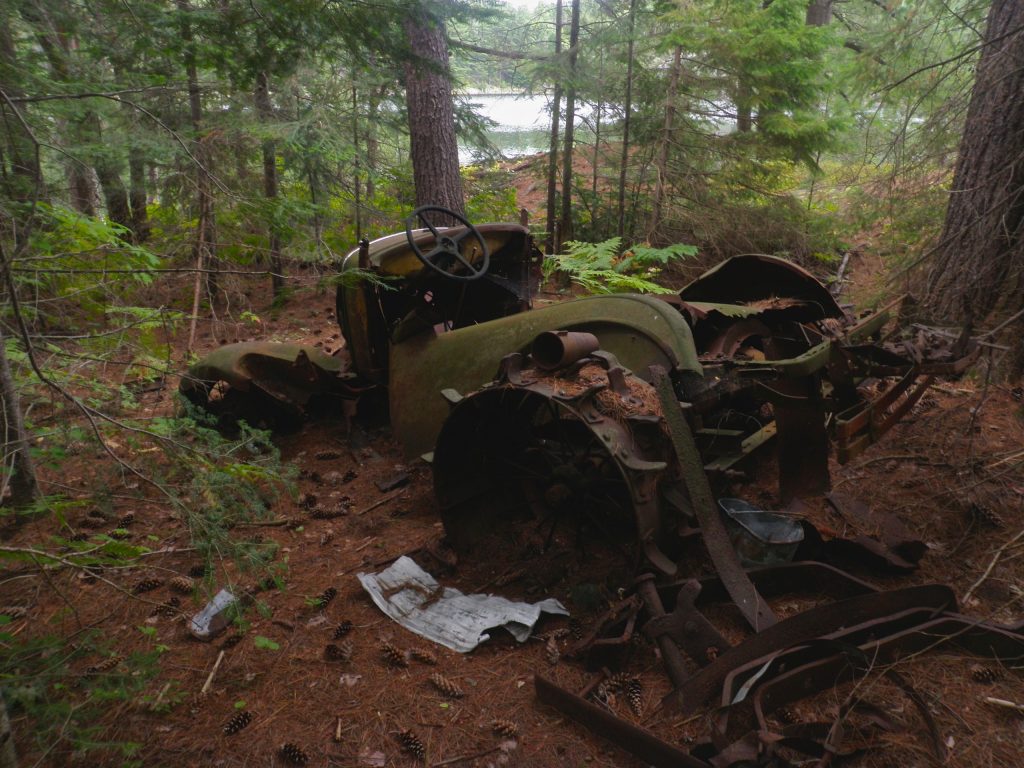
We spent a bit of time looking for the stone icehouse that’s marked on Jeff’s Map, but we couldn’t find it. Then while Alex ran back for the life jacket I spotted the icehouse right next to where I’d put the canoe down. It’s not a very impressive (or obvious) structure, just a ring of stones in the ground. I’d still be interested to learn a bit more about this building. We did find various bits of metal as we looked for the icehouse, some of which looked like vehicle parts, but they were partially buried so it was hard to tell.
We were making good time so when we got to Nellie Lake we did a bit of exploring. There’s a peak on the peninsula that separates the main body of Nellie Lake from the bay that’s referred to as Carmichael Lake. The peak is easy to climb and offers a great view of the area.
Nellie Lake has a trick. The azure water of the lake is crystal clear and under the right conditions you can see all the way to the bottom. Unfortunately for us, while the day had started out bright and sunny, by the time we got to Nellie it was grey and threatening rain. Nellie Lake needs the sun to show off it’s clear water. Even without its trick Nellie is one of the most scenic lakes in the park. It’s very long and narrow, with steep white shores like a Norwegian Fjord. Our vantage point on the small peak gave us a great view to observe the entire lake. The water was a bit choppy, and we could watch patches of wind cut the surface up into different patterns as they swept across the lake.
Without the sun the astonishing colour of the clear waters of Nellie Lake isn’t evident, but it’s still a beautiful lake.
This lone tree is perched on top of a scenic little mountain on Nellie Lake.
There are only three campsites on Nellie Lake, but we saw several groups of people. As we neared the portage to Grace Lake we met a mother and son on their first canoe trip, finishing the tough portage. The young boy looked to be about nine or ten but he was very engaged in the trip and had the guidebook in hand. He was asking about several landmarks he wanted to see in the area. It’s always nice to meet different kinds of groups enjoying the backcountry.
The portage from Nellie to Grace starts out like a ladder, going almost straight uphill, but after a relatively short climb it’s all downhill to Grace Lake. It’s a very scenic portage, but I didn’t get much of a chance to look around this time because we were doing another single carry. I didn’t realize it at the time, but when we stopped at the highest point of the portage to take a break we were only a few metres from one of the hidden “Paddle In The Park” paddles. The paddles are hidden to encourage people to get out in the parks, and for a disgruntled geocacher like me finding one would be a real thrill. Not only have I been too busy with renovations this summer to follow the contest, the hint that clinched the location of that paddle was released that very morning, so even if I had been following I wouldn’t have read it.
Grace Lake is a dramatic, intimate place that embodies the rugged beauty that is Killarney. Perched atop the northern LaCloche hills high above the land below it’s ringed by steep rounded peaks. Small rocky islands covered in trees are scattered across the water. We chose site 180 at the western end of the lake which offers an excellent view of the sun rising between the peaks we had just portaged the canoe over. While the site does offer great views we weren’t able to find a thunder box which may be a consideration when choosing this site (there are many paths at the site so it may be that we just couldn’t find the box).
Earlier in the day I had made the mistake of telling Alex that while Nellie Lake loves the sun, the moody gothic landscape of Grace is often prettiest in the rain and mist. As if on cue it started to rain that night and we saw very little sun for our two nights on Grace. The rain did hold off until we’d finished dinner and put the dishes away, so we felt pretty well prepared as we ducked under our tarp and watched the storm in relative comfort. The rain was soon strong enough that it quickly extinguished our fire, but we barely got wet.
The storm intensified through the night and I had my first opportunity to enjoy a thunderstorm while sleeping in a hammock. The lightning was about ten seconds away, but that’s enough to make quite a bit of noise and light up the sky dramatically. I had set my hammock up with the fly a bit high and I was worried that water was dripping onto my feet. A bit was splashing on the ground and then up under the tarp, but most of what I was feeling was the drops of water vibrating the tie out lines for the hammock. It was a cold night and I didn’t want to risk getting my sleeping bag wet so I experimented with putting my feet up on the high side of the hammock, but that was too uncomfortable. I was starting to be jealous of Alex in his tent, but when he got up the next morning I found out that he was even more wet thanks to a leaky fly.
Normally I read quite a bit while camping, but we’d been staying up pretty late and I’d been sleeping uncharacteristically well, so this was the first night of the trip that I did much reading. I eventually drifted off to sleep, but was woken by thunderbolts several times.
We didn’t see much sun while on Grace Lake, but it did poke through one morning as it rose.
The rain seemed to have stopped by dawn, but the clouds weren’t letting the sun through at all. It sprinkled rain a couple of times while I made pancakes for breakfast, but it did seem to be clearing up by the time we headed out to do some ridge running. There are inviting hills all around Grace Lake, but we decided to visit Carmichael’s Rock first and then see how time and the weather left us.
The climb up to the rock was a bit more difficult than I remembered, particularly with the rocks so wet. I managed to find the rock without having to rely much on my GRSr even though I didn’t have a printout of the photo to guide me this year. (Just like last year I’ve deleted the actual location of the rock from my GPS track logs).
Alex contemplates the same view that Franklin Carmichael did 80 years ago.
The portage from Grace to Nellie runs through the saddle at the east end of the lake.
Looking north we can see the northern boundary lakes that we traversed just a few days ago. It also gives a sense of just how high Grace Lake is up in the mountains.
The view is a bit restricted looking south from this peak, but we could see a dark gray storm cloud coming our way. Within minutes we were drenched.
As we descended the hill we could see the rain sweeping across the lake below.
We climbed to the top of a nearby peak to see the view and decide what to do next. From the peak Grace Lake stands out against the hills even further below, highlighting the fact that it’s perched high up in the hills. When we turned to look south we could see the hills and islands of McGregor Bay receding into the mist below and a dark storm cloud heading our way from above! There was no time to find any shelter better than some trees, and within minutes the storm was upon us, beating down with torrential rain. We tried to wait the rain out but it showed no signs of letting up after a few minutes, and we decided to head downhill when we heard a warning rumble from the sky.
We had to proceed very carefully down the hill on the wet rocks. Normally I’m very diligent about turning the canoe over, but this time I forgot, and when we found it the back end was already full of water. There had been no more thunder so we dumped out the boat and paddled back to our campsite in the torrential rain. By the time we got back to our tarp we were thoroughly soaked and there was no sun to dry out our clothes.
We changed into the driest stuff we had, and then began a long wait for the rain to stop. I had hoped that we could do some more exploring later in the day, but the threat of rain never passed for long enough for us to venture out again, so we just watched the clouds and talked.
Back at our campsite it’s hard to tell the difference between clouds and rain as they sweep through the hills.
Cloud watching on Grace Lake is an interesting experience because at times the hills, and even the lake, are in the clouds. Sometimes the east end of the lake would disappear entirely, and then the large mounds of rock surrounding the lake would slowly begin to reappear, at first as dim shadows which slowly resolved themselves into white hills, until finally we could watch tendrils of fog and mist wrap themselves around the peaks and through the valleys. When the water came down hard the sheets of rain would curl and twist across the landscape.
We did finally get enough of a dry spell to get a fire going, and we were able to emerge from the tarp for long enough to cook dinner in the open, but then the rain came again and put out our fire. We decided to call it a day and go to bed early when Alex was bitten by one of the carpenter ants that were infesting our refuge. I had hoped to read a bit before going to sleep, but as soon as I got settled in my hammock the batteries in my flashlight died, so after a bit of tossing and turning I finally went to sleep.
Since Sunday was our last day and we wouldn’t have to make camp that night I had hoped that we’d be able to do some more hiking before leaving Grace Lake, but the rain continued to threaten all morning. We cooked up the last of our food for breakfast. We were at the bottom of the food bag, so we ended up eating porridge and chilli for breakfast while we watched the skies hoping for a break in the clouds. We watched for quite a while, but rain didn’t completely stop until we were almost ready to leave.
On the whole I can’t really complain about the weather, even though it did rain for most of the last two days of the trip. I was a bit disappointed that we weren’t able to do more exploring in the hills surrounding Grace Lake, but the rain and mist do complement the landscape well. And after six days of spectacular weather the rain was just another aspect of life outdoors. I would have been much more disappointed if our entire trip had been rained out, so I hope that the people we met camping for the Labour Day weekend managed to enjoy their wet backcountry experiences.
The portage from Grace Lake back down to Frood Lake is another very scenic trail. Normally it crosses the creek in a couple of places where strategically placed rocks and logs make it possible (if not prudent) to cross with dry feet. Today the runoff from the rain had transformed the path into a mudslide. The creek that gurgles next to the trail was now fed by a torrent of water running down the middle of the trail. One of the water crossings had me almost up to my knees in cool rainwater, which did at least help to wash the mud off of my sandals.
Alex was trying to stay out of the water, but with one pack on the back and another on the front he couldn’t see the ground so he had to keep putting one bag down in order to choose his footing. In one particularly tricky section he slipped while jumping on a log and almost had a nasty accident.
I had to put the canoe and pack down a couple of times on the way down to give my shoulders a break, and the last stretch of trail seemed agonizingly long, but we finally made it to the bottom and the long paddle back to the car. For once the weather was on our side and there was no wind on Frood Lake. At times it can be pretty strong through here making the paddling difficult. It still took us a few hours to make it back to the car, but it was easy paddling past the cottages and lodges outside the park.
Frood Lake
Tips
There are multiple challenges on this trip including long portages and some areas that are difficult to navigate. It isn’t a trip for novice canoeists.
Some of the portages are long and quite steep. Distribute your gear wisely keeping the portages in mind. The perfect combination for us was three light packs (25lb, 25lb and 35lb) and one ultralight canoe for two people.
While the northern lakes see less traffic much of this trip passes through some very popular areas, so make sure that you book early to get the sites that you want.
We didn’t see many people on some portions of the trip, but we did encounter at least one group on every day of the trip.
Consider a water taxi to shorten the paddle on the first day.
Leave time in the schedule to account for fluctuating water levels, but if possible avoid booking the less scenic northern lakes.
There will be some motorboat traffic on the northern border lakes, and many of the interior lakes will have cottages and some traffic as well. Even if Killarney truly becomes a wilderness park, the western portion of this route outside of the park through McGregor bay does pass by quite a few cottages.
Doing this trip clockwise like we did is much easier than doing the reverse. Not only are more of the portages downhill, the worst portages don’t come until near the end of the trip when the load is lighter.